Video
Oct 31, 2017
Landsat sensors: push broom vs whisk broom: Landsat 7
Landsat collects images in long narrow strips called “swaths.” Each swath is 185 kilometers (115 miles) wide and is...
GSFC
Image
Nov 8, 2002
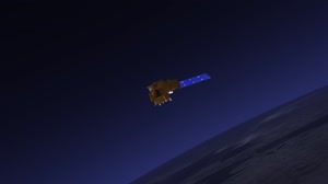
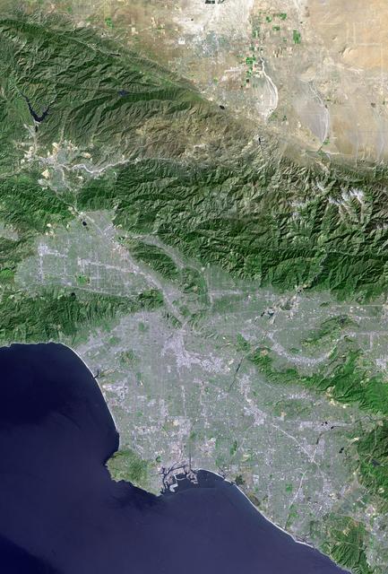
Landsat with SRTM Shaded Relief, Los Angeles and Vicinity from Space
Los Angeles and vicinity seen from space, as viewed by NASA Landsat 7 satellite from an altitude of 437 miles on May...
JPL
Video
Apr 7, 2009
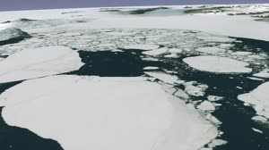
Guided Tour of LIMA Flyover
In 2007, more than 1,100 Landsat 7 images were used to create the first ever, high-resolution, true color map of...
GSFC
Image
Dec 8, 2017
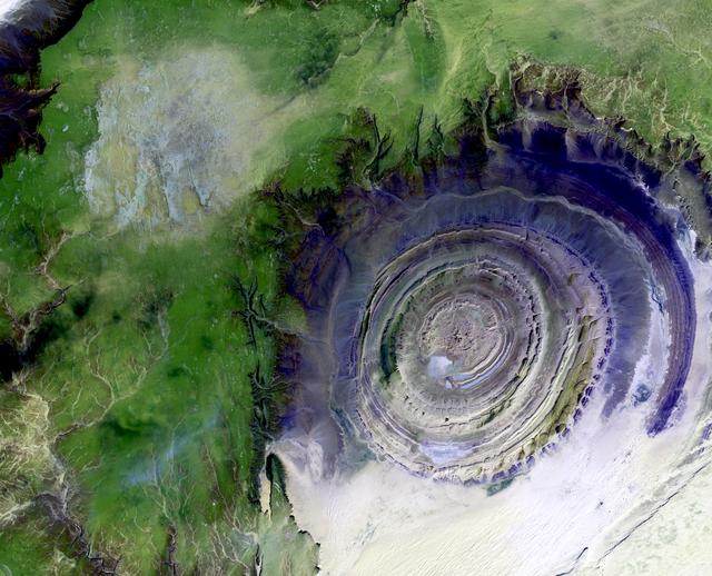
Richat Structure
Image taken 1/11/2001: The so-called Richat Structure is a geological formation in the Maur Adrar Desert in the...
GSFC
Image
Dec 8, 2017
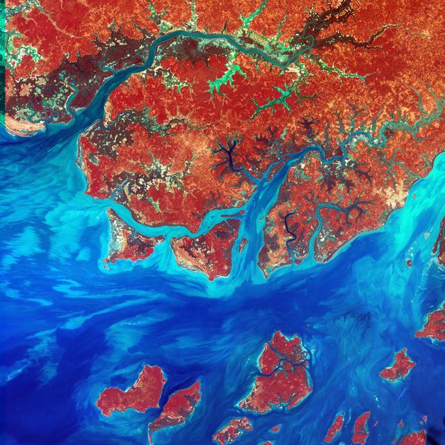
Guinea-Bissau
This Landsat 7 image of Guinea-Bissau, a small country in West Africa, shows the complex patterns of the country's...
GSFC
Image
Dec 8, 2017
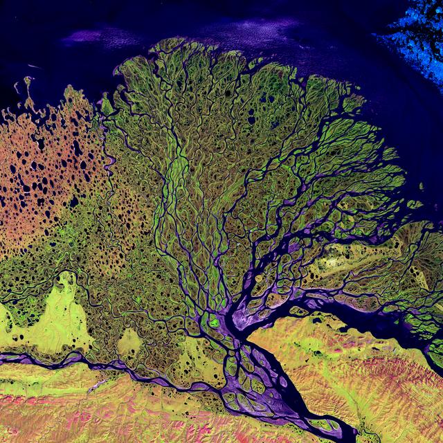
Lena Delta
Image taken 7/27/2000: The Lena River, some 2,800 miles (4,400 km) long, is one of the largest rivers in the world....
GSFC
Image
Dec 8, 2017
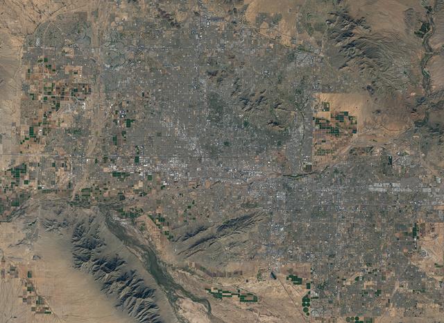
NASA Satellite Captures Super Bowl Cities - Phoenix
Landsat 7 image of Phoenix, Arizona acquired November 28, 2014. Landsat 7 is a U.S. satellite used to acquire...
GSFC
![NASA image: NASA Satellite Captures Super Bowl Cities - Phoenix [annotated]](https://images-assets.nasa.gov/image/GSFC_20171208_Archive_e000803/GSFC_20171208_Archive_e000803~thumb.jpg)
Image
Dec 8, 2017
NASA Satellite Captures Super Bowl Cities - Phoenix [annotated]
Landsat 7 image of Phoenix, Arizona acquired November 28, 2014. Landsat 7 is a U.S. satellite used to acquire...
GSFC
Image
Dec 8, 2017
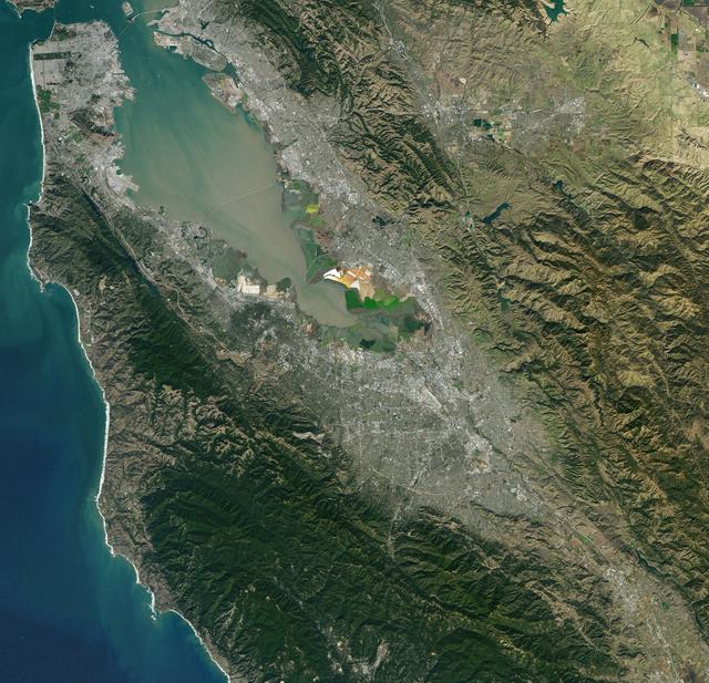
NASA Satellite Captures Super Bowl Cities - Santa Clara, CA
Landsat 7 image of the Santa Clara area acquired Nov 16, 2015. Landsat 7 is a U.S. satellite used to acquire...
GSFC
Image
Dec 8, 2017
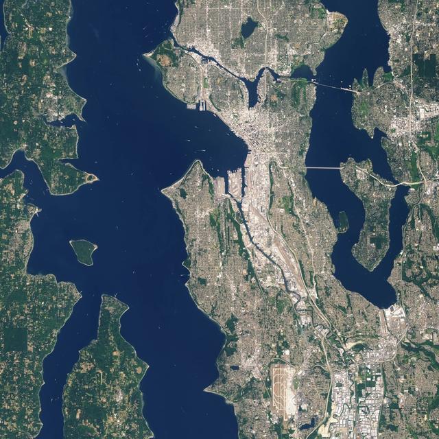
NASA Satellite Captures Super Bowl Cities - Seattle
Landsat 7 image of Seattle, Washington acquired August 23, 2014. Landsat 7 is a U.S. satellite used to acquire...
GSFC
Image
Dec 8, 2017
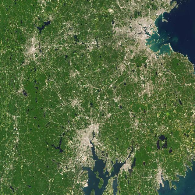
NASA Satellite Captures Super Bowl Cities - Boston/Providence
Landsat 7 image of Boston/Providence area acquired August 25, 2014. Landsat 7 is a U.S. satellite used to acquire...
GSFC

Image
Dec 8, 2017
NASA Satellite Captures Super Bowl Cities - Charlotte, NC
Landsat 7 image of the Charlotte, NC area acquired Oct 18, 2015. Landsat 7 is a U.S. satellite used to acquire...
GSFC
![NASA image: NASA Satellite Captures Super Bowl Cities - Seattle [annotated]](https://images-assets.nasa.gov/image/GSFC_20171208_Archive_e000801/GSFC_20171208_Archive_e000801~thumb.jpg)
Image
Dec 8, 2017
NASA Satellite Captures Super Bowl Cities - Seattle [annotated]
Landsat 7 image of Seattle, Washington acquired August 23, 2014. Landsat 7 is a U.S. satellite used to acquire...
GSFC
![NASA image: NASA Satellite Captures Super Bowl Cities - Boston/Providence [annotated]](https://images-assets.nasa.gov/image/GSFC_20171208_Archive_e000805/GSFC_20171208_Archive_e000805~thumb.jpg)
Image
Dec 8, 2017
NASA Satellite Captures Super Bowl Cities - Boston/Providence [annotated]
Landsat 7 image of Boston/Providence area acquired August 25, 2014. Landsat 7 is a U.S. satellite used to acquire...
GSFC
Image
Dec 8, 2017
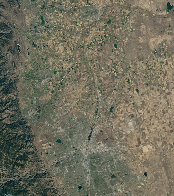
NASA Satellite Captures Super Bowl Cities - Denver, CO
Landsat 7 image of Denver area acquired Nov 3, 2015. Landsat 7 is a U.S. satellite used to acquire remotely sensed...
GSFC
Video
May 23, 2013
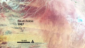
Pivot Irrigation in Saudi Arabia
Saudi Arabia is drilling for a resource possibly more precious than oil. Over the last 24 years, it has tapped...
GSFC
Image
Dec 8, 2017
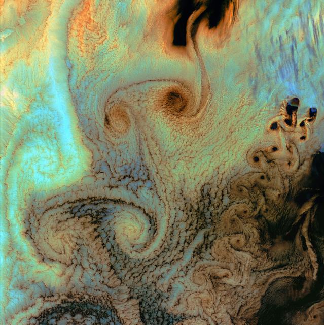
Von Karman Vortices
July 4th, 2002: Description: As air flows over and around objects in its path, spiraling eddies, known as Von Karman...
GSFC
Image
Dec 8, 2017
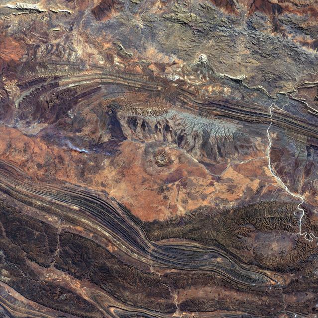
Gosses Bluff
August 14th, 2002: Description: 142 million years ago, an asteroid or comet slammed into what is now the Missionary...
GSFC
Image
Jul 7, 2021
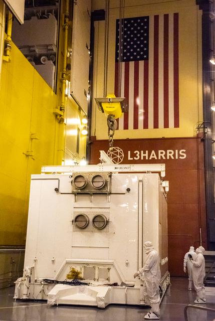
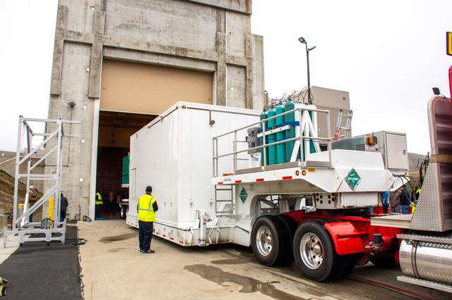
Landsat 9 Spacecraft (Observatory) Unloading from Shipping Conta
Technicians prepare to remove the satellite for the Landsat 9 mission from its shipping container following its...
KSC
Image
Jul 7, 2021
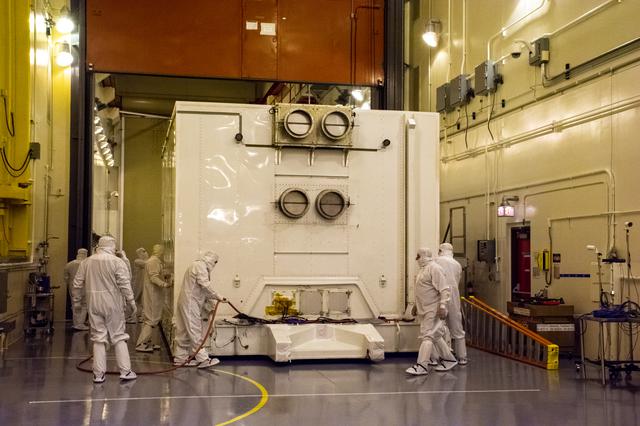
Landsat 9 Spacecraft Arrival (Observatory)
Technicians remove the satellite for the Landsat 9 mission from its shipping container following its arrival at...
KSC
Image
Jul 7, 2021
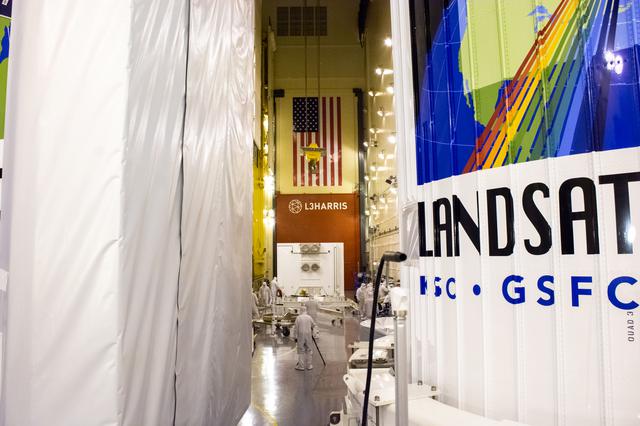
Landsat 9 Spacecraft Arrival (Observatory)
The satellite for the Landsat 9 mission, secured inside its shipping container, arrives at the Integrated Processing...
KSC
Image
Jul 7, 2021
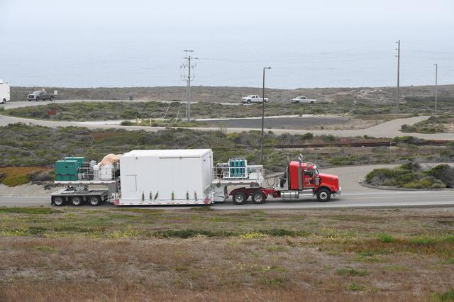
Landsat 9 Spacecraft (Observatory) Arrival
The satellite for the Landsat 9 mission, secured inside its shipping container, is transported by truck to...
KSC
Video
Oct 31, 2017
Landsat sensors: pushbroom vs whiskbroom: Landsat 8
Landsat collects images in long narrow strips called “swaths.” Each swath is 185 kilometers (115 miles) wide and is...
GSFC
Image
Jul 7, 2021
Landsat 9 Spacecraft Arrival (Observatory)
Technicians move the shipping container, carrying the satellite for the Landsat 9 mission, into the Integrated...
KSC