Image
Jul 21, 2001
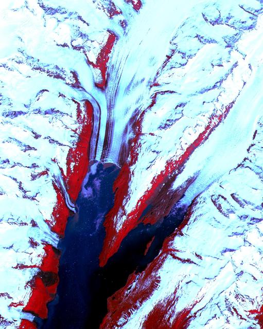
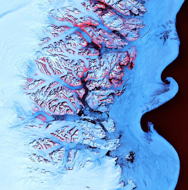
College Fjord, Prince Williams Sound
The College Fjord with its glaciers was imaged by ASTER on June 24, 2000. This image covers an area 20 kilometers...
JPL

Image
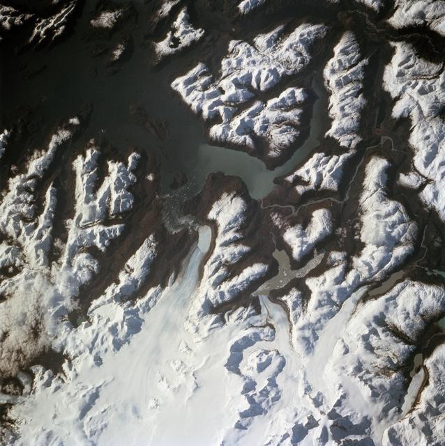
Dec 8, 2017
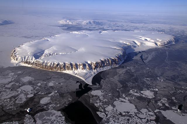
SW Greenland Fjord and Mountain
On April 8, 2011, IceBridge flew a mission to coastal areas in southwest Greenland. Mountains and an open-water...
GSFC
Image
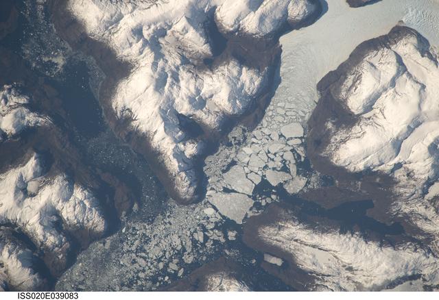
Dec 8, 2017
IceBridge Survey Flight Over Saunders Island and Wolstenholme Fjord
This image of Saunders Island and Wolstenholme Fjord with Kap Atholl in the background was taken during an Operation...
GSFC
Image
Oct 31, 2024
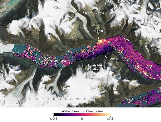
SWOT Captures Planet-Rumbling Greenland Tsunami
A visualization based on data from the international SWOT satellite mission shows the unique contours of a tsunami...
JPL
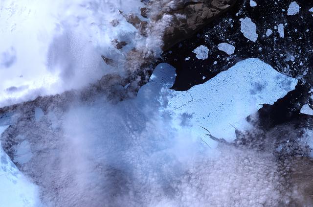
Image
Jan 25, 2021
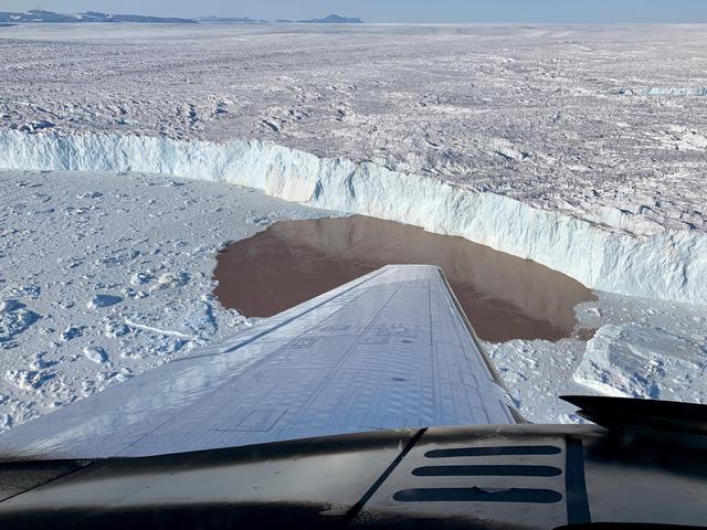
Glacier Undercutting in Action
In this aerial view, a glacier along Greenland's craggy coastline is actively undergoing undercutting, a process in...
JPL
Image
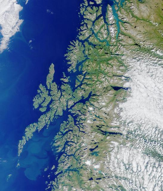
Sep 26, 2001
Where on Earth...? MISR Mystery Image Quiz #3:<br .>Lofoten Islands, Norway
Lofoten Islands, Norway. Norway is deeply indented by fjords, rises precipitously to high plateaus, and is united...
JPL
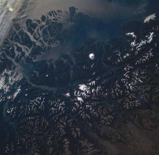
Image
Sep 30, 1994
Andes Mountains, Chile
STS068-260-078 (30 September-11 October 1994) --- The ice visible along the bottom of this view is the north end of...
JSC
Image
Sep 6, 2009
Earth Observation taken by the Expedition 20 crew
ISS020-E-039083 (6 Sept. 2009) --- Glacier outlet in the Southern Patagonian Ice Field of Chile is featured in this...
JSC
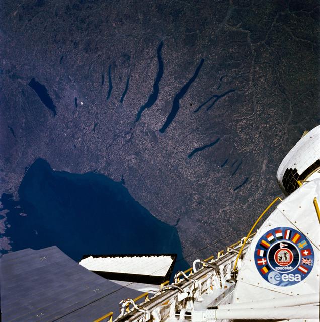
Image
Jun 25, 2009
51B earth observation
51B-33-028 (29 April-6 May 1985) --- An excellent view of the Finger Lakes area of New York, and including Lake...
JSC
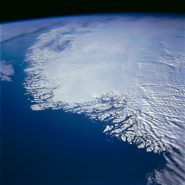
Image
Nov 14, 1994
Greenland as seen by the STS-66 shuttle Atlantis
This north-looking view of southwestern Greenland was taken in November, 1994, and shows numerous indentations, many...
JSC
Image
Feb 9, 1994
The Southern Andes of South America as seen from STS-60
STS060-85-000AH (3-11 Feb 1994) --- This view is centered at about 44 degrees south along the Chilean continental...
JSC
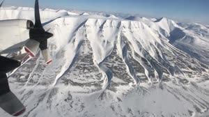
Video
May 17, 2017
IceBridge tackles Svalbard, North Pole, and Greenland in One Day
Operation IceBridge just completed 40 research flights over ten weeks, including three based out of the remote and...
GSFC
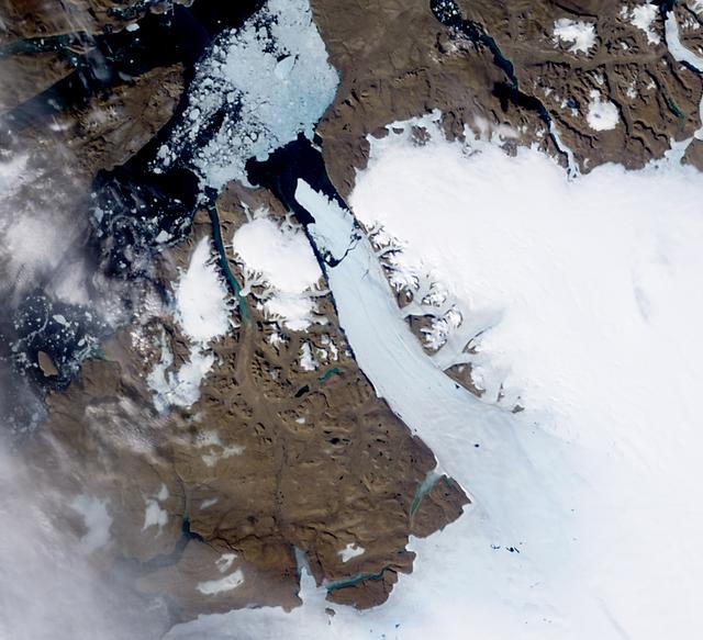
Image
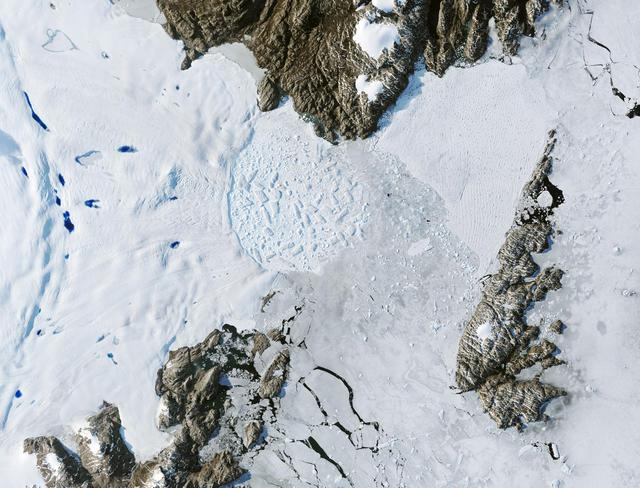
Dec 8, 2017
Ice Island Calves off Petermann Glacier
NASA image acquired August 11, 2010. After breaking off the Petermann Glacier on August 5, 2010, a massive ice...
GSFC
Image
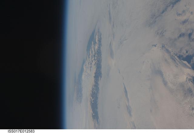
Aug 4, 2008
Earth Observations taken by the Expedition 17 Crew
ISS017-E-012583 (4 Aug. 2008) --- Cape Farewell, Greenland is featured in this image photographed by an Expedition...
JSC
Image
Dec 8, 2017
Ice Waves
Ice Waves - May 21st, 2001 Description: Along the southeastern coast of Greenland, an intricate network of fjords...
GSFC
Image
Dec 8, 2017
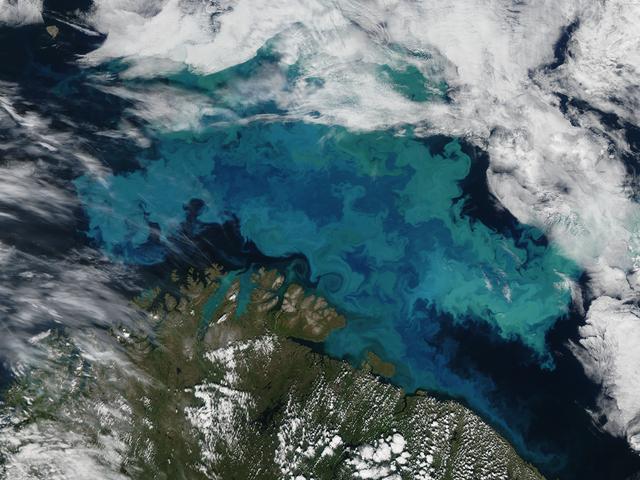
Barents Sea
Phytoplankton bloom in the Barents Sea captured August 14, 2011. At times nature exceeds the ability of the artist’s...
GSFC
Image
Jan 17, 2024
Retreat of Greenland's Zachariae Isstrom Glacier
Satellite images from 2022 (Main image) and 1999 (Figure A) capture the retreat of Zachariae Isstrom, a glacier in...
JPL
Image
Jan 17, 2024
Retreat of Greenland's Jakobshavn Isbrae Glacier
Satellite images from 2022 (Main image) and 1985 (Figure A) capture the retreat of Jakobshavn Isbrae, a glacier on...
JPL
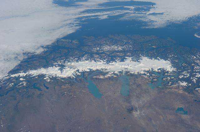
Image
Feb 14, 2014
Earth Observations taken by Expedition 38 crewmember
ISS038-E-047324 (13 Feb. 2014) --- This grand panorama of the Southern Patagonia Icefield (center) was imaged by an...
JSC
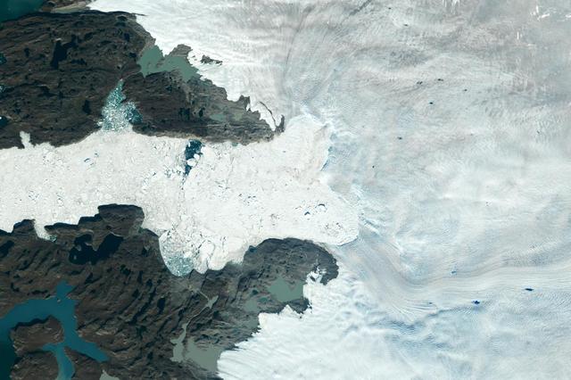
Image
Dec 8, 2017
Ice Island calves off Petermann Glacier
NASA image acquired August 5, 2010 On August 5, 2010, an enormous chunk of ice, roughly 97 square miles (251 square...
GSFC
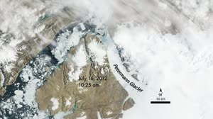
Video
Oct 18, 2012
Petermann Ice Island 2012
In the spring and summer of 2012, land- and sea ice thinned in some regions within the Arctic Circle and completely...
GSFC