Image
Dec 8, 2017
The Rivers of the Mississippi Watershed
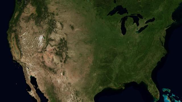
The Mississippi Watershed is the largest drainage basin in North America at 3.2 million square kilometers in area....
GSFC
Video
Jan 31, 2013
Monitoring Changes in the Chesapeake Bay Watershed
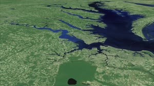
Landsat is a critical and invaluable tool for characterizing the landscape and mapping it over time. Landsat data...
GSFC
Image
Dec 11, 2024
Projections of Saltwater Intrusion in Coastal Watersheds by 2100
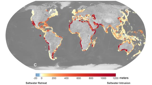
A recent study led by researchers at NASA's Jet Propulsion Laboratory in Southern California that seawater will...
JPL
Video
Jun 26, 2019
NASA Tracks the Future of Asia's Glaciers
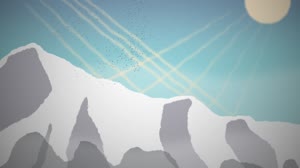
Asia’s high mountains are a crucial freshwater source to one-seventh of the world’s population. Snow and glaciers in...
GSFC

Video
Jul 13, 2023
Space to Ground: Watershed Moment: July 14, 2023
NASA's Space to Ground is your weekly update on what's happening aboard the International Space Station.
JSC
Image
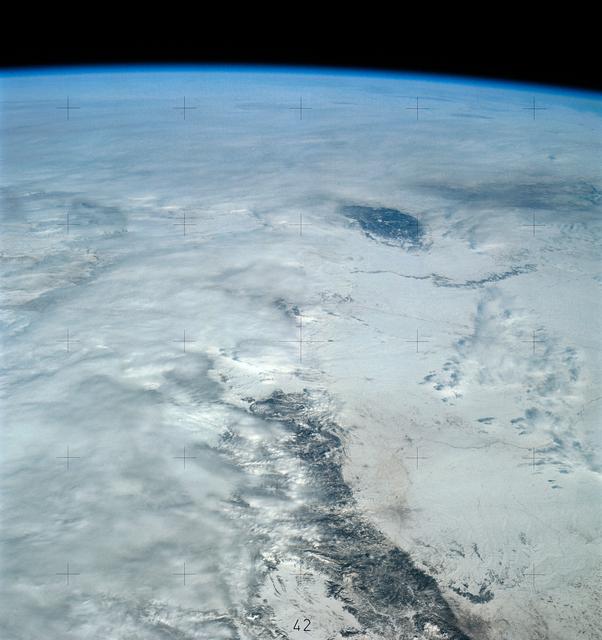
Jan 10, 1974
View of portion of Western United States as seen by Skylab
SL4-139-4040 (10 Jan. 1974) --- An oblique view of a portion of the Western United States, as photographed from the...
JSC
Image
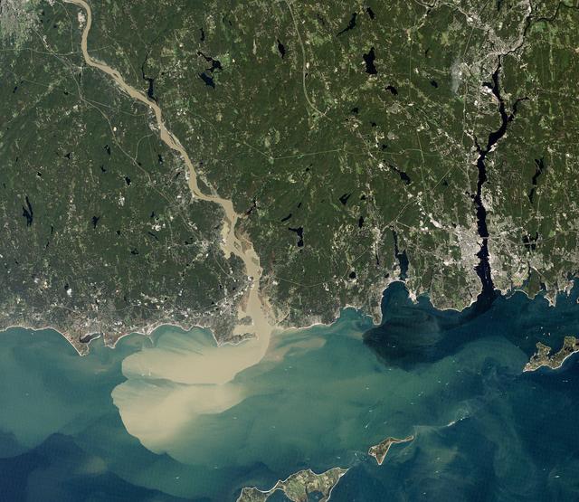
Dec 8, 2017
Sediment Spews from Connecticut River
NASA image acquired September 2, 2011 To download the full high res go to:...
GSFC
Image
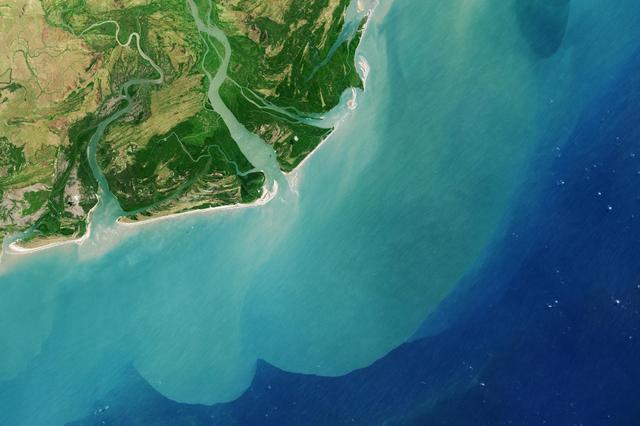
Aug 29, 2013
Zambezi River Delta
It drains a watershed that spans eight countries and nearly 1.6 million square kilometers 600,000 square miles. The...
JPL
Image
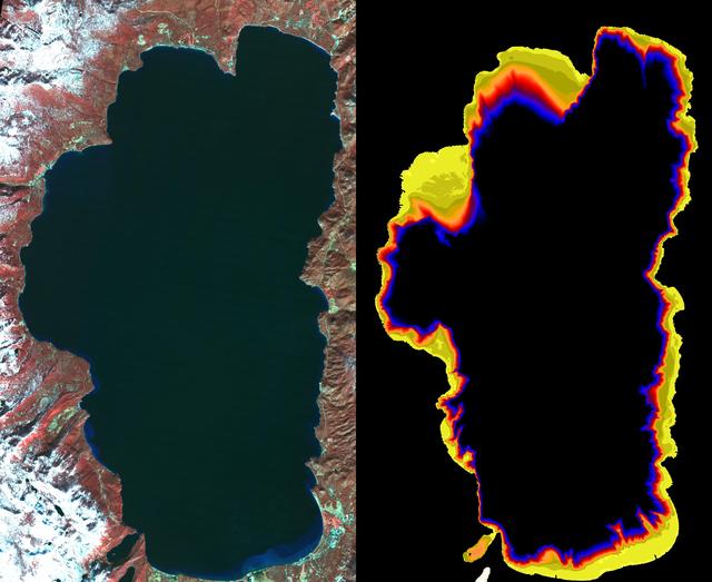
Aug 6, 2002
NASA Images Show Decreased Clarity in Lake Tahoe Water
Images from the Advanced Spaceborne Thermal Emission and Reflection Radiometer aboard NASA's Terra satellite,...
JPL
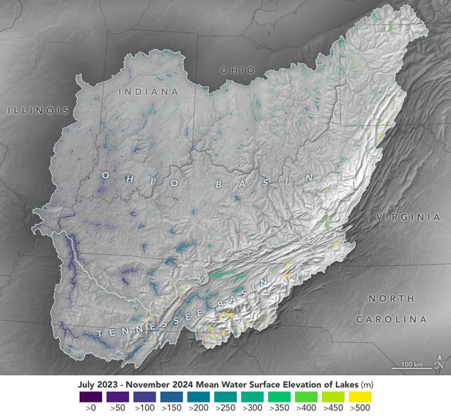
Image
Dec 17, 2024
Ohio Basin Lakes Water Levels
This visualization based on data from the Surface Water and Ocean Topography (SWOT) satellite shows the average...
JPL
Image
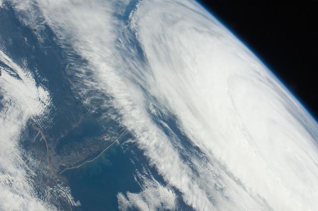
Sep 9, 2011
Earth observation taken by the Expedition 28 crew
ISS028-E-045516 (9 Sept. 2011) --- Hurricane Katia off the northeastern USA coastline is featured in this image...
JSC
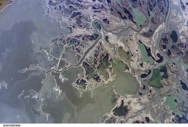
Image
May 11, 2007
Earth Observations taken by the Expedition 15 Crew
ISS015-E-07649 (11 May 2007) --- Saskatchewan River Delta, Manitoba, Canada is featured in this image photographed...
JSC
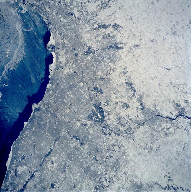
Image
Feb 9, 1994
Chicago, Illinois as seen from STS-60
STS060-103-089 (3-11 Feb. 1994) --- The Chicago, Illinois area is in this northeast looking low oblique view...
JSC
Image
Jan 12, 2006
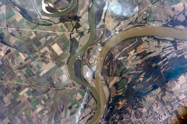
iss012e15035
ISS012-E-15035 (12 Jan. 2006) --- The confluence of the Ohio and Mississippi Rivers at Cairo, Illinois is featured...
JSC

Image
Dec 8, 2017
Sequoia National Park
Naked peaks, sheltered valleys, snowfields, towering trees, and alpine meadows make up the varied landscape of...
GSFC
Image
Nov 3, 2011
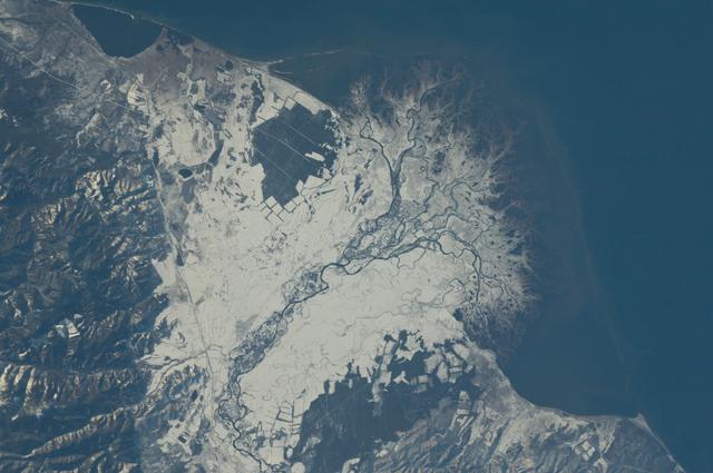
Earth observation taken by the Expedition 29 crew
ISS029-E-037915 (3 Nov. 2011) --- Snowfall on the Selenga River Delta, Russian Federation is featured in this image...
JSC
Image
Apr 30, 2012
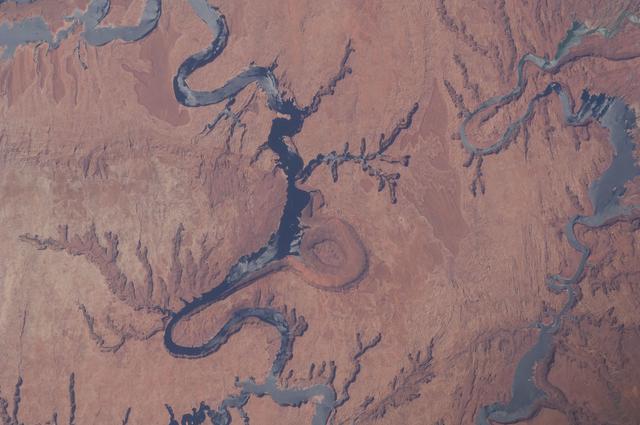
Earth Observations taken by the Expedition 31 Crew
ISS031-E-006398 (30 April 2012) --- Lake Powell and the Rincon in Utah are featured in this image photographed by an...
JSC
Image
Sep 20, 2021
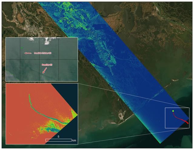
Delta-X Oil Slick Radar Signal in Gulf of Mexico
An oil slick in the Gulf of Mexico following Hurricane Ida – a high-end Category 4 when it made landfall near Port...
JPL
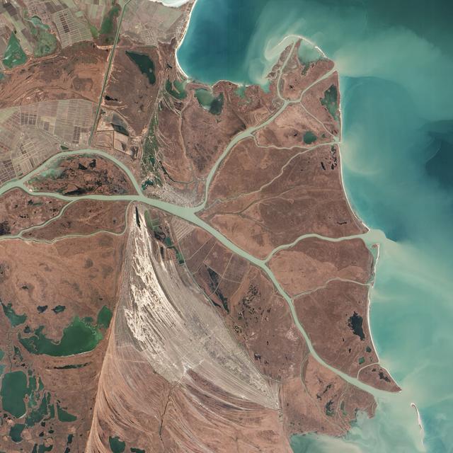
Image
Dec 8, 2017
Where the Danube Meets the Black Sea
Acquired February 5, 2013 The Danube River is the largest in the European Union, its watershed draining 801,463...
GSFC
Audio
Aug 1, 2025
HWHAP Ep395 Constructing NASA Infrastructure
Ep395_Constructing NASA Infrastructure Dane Turner Houston, We Have a Podcast. Welcome to the official podcast of...
JSC