Image
Nov 13, 2007
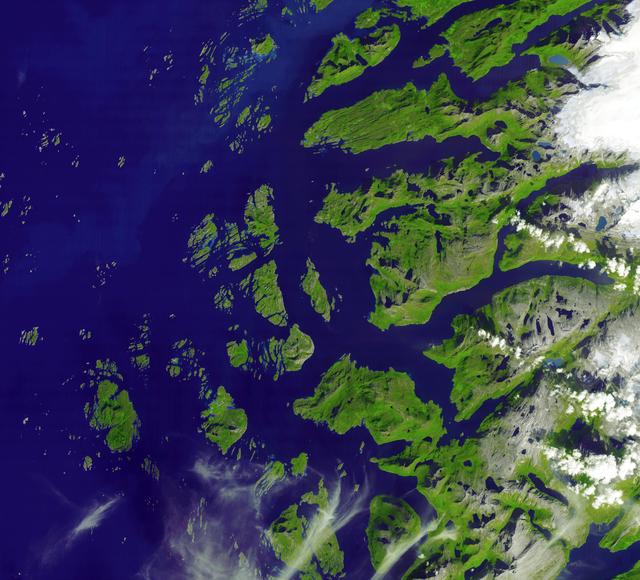
Saltfjellet-Svartisen Park, Norway
The Arctic Circle cuts through the western coast of Norway and the Saltfjellet-Svartisen National Park. This image...
JPL

Video
Feb 16, 2015
Landsat 8 Crosses the Arctic
On June 21, 2014—the summer solstice—when the Sun stays above the horizon of the Arctic for at least 24 hours,...
GSFC

Video
Sep 3, 2014
A Selective History of Arctic Sea Ice Observations Part 1
Arctic sea ice has been been the last frontier of the North for thousands of years, turning back seafarers, testing...
GSFC
Video
Sep 3, 2014
A Selective History of Arctic Sea Ice Observations Part 2
Arctic sea ice has been been the last frontier of the North for thousands of years, turning back seafarers, testing...
GSFC
Video
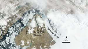
Oct 18, 2012
Petermann Ice Island 2012
In the spring and summer of 2012, land- and sea ice thinned in some regions within the Arctic Circle and completely...
GSFC
Image
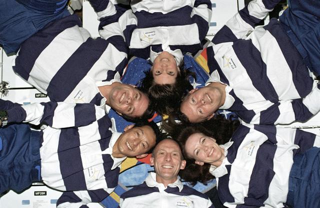
Feb 1, 2000
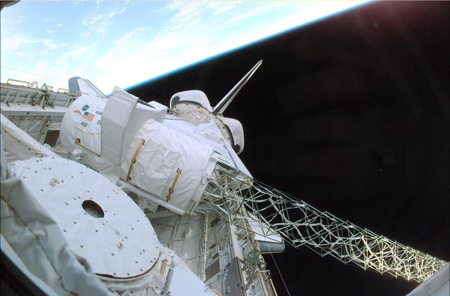
Space Shuttle Projects
The STS-99 crew pose for a "star-burst" pose in celebration of a successful Shuttle Radar Topographic Mission (SRTM)...
MSFC
Image
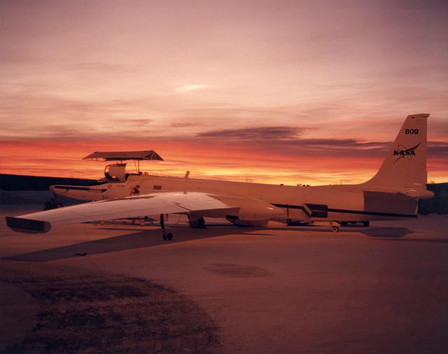
Jan 28, 2000
ER-2 #809 awaits pilot entry for the third flight of the SAGE III Ozone Loss and Validation Experiment (SOLVE)
ER-2 #809 awaiting pilot entry for the third flight of the SAGE III Ozone Loss and Validation Experiment (SOLVE)....
AFRC
Image
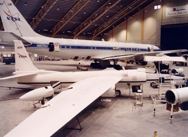
Jan 23, 2000
ER-2 #809 and DC-8 in Arena Arctica hangar in Kiruna, Sweden prior to the SAGE III Ozone Loss and Validation Experiment (SOLVE)
NASA ER-2 # 809 and its DC-8 shown in Arena Arctica before the SAGE III Ozone Loss and Validation Experiment...
AFRC
Image
Feb 16, 2000
Space Shuttle Projects
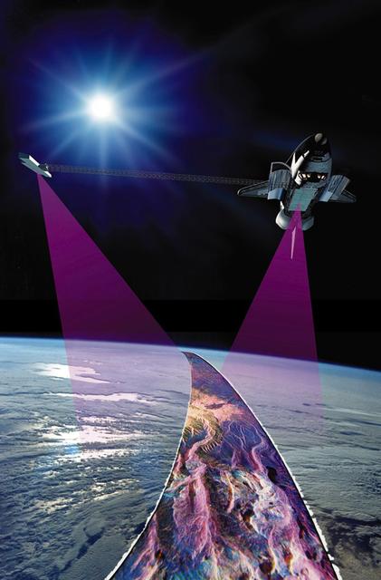
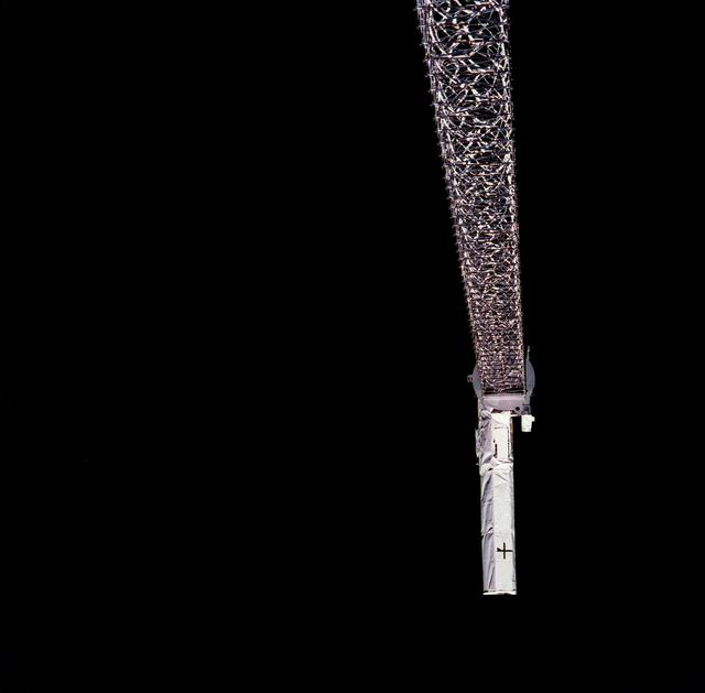
Launched February 11, 2000, the STS-99 Shuttle Radar Topographic Mission (SRTM) was the most ambitious Earth mapping...
MSFC
Image
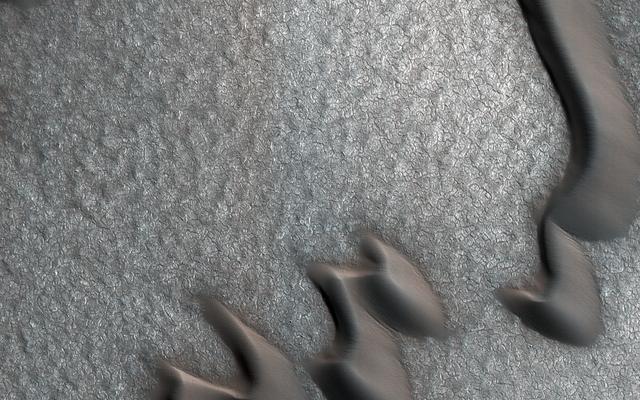
Mar 5, 2018
The Case of the Martian Boulder Piles
This image from NASA's Mars Reconnaissance Orbiter (MRO) was originally meant to track the movement of sand dunes...
JPL
Image
Jan 1, 2000
Space Shuttle Projects
Launched February 11, 2000, the STS-99 Shuttle Radar Topographic Mission (SRTM) was the most ambitious Earth mapping...
MSFC
Image
Feb 11, 2000
Space Shuttle Projects
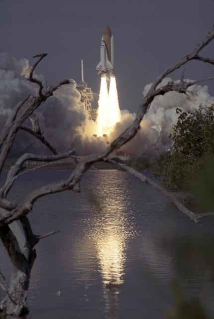
The Space Shuttle Orbiter Endeavour blasts form the launch pad on February 11, 2000 carrying its crew of six for the...
MSFC
Image
Feb 1, 2000
Space Shuttle Projects
Launched February 11, 2000, the STS-99 Shuttle Radar Topographic Mission (SRTM) was the most ambitious Earth mapping...
MSFC
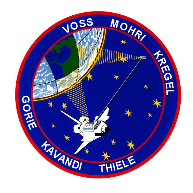
Image
Jun 1, 1999
Space Shuttle Projects
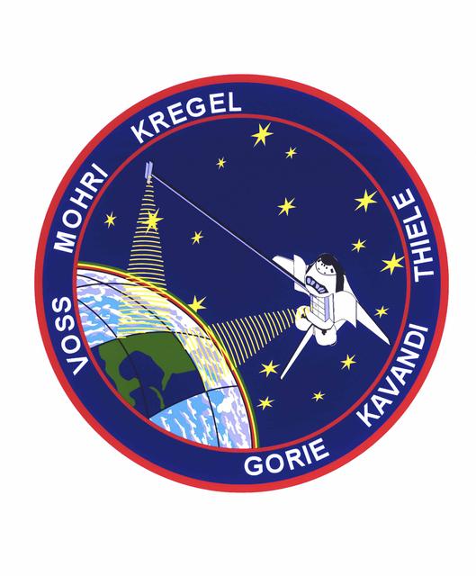
The STS-99 crew members designed the flight insignia for the Shuttle Radar Topography Mission (SRTM), the most...
MSFC
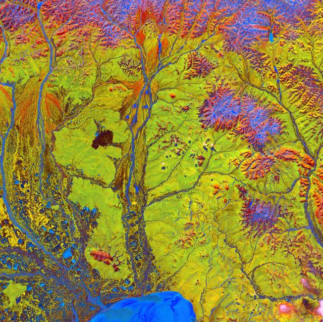
Image
Dec 8, 2017
Siberian Ribbons
Siberian Ribbons - June 15th, 2005 Description: Vivid colors and bizarre shapes come together in an image that could...
GSFC
Image
Jun 1, 1999
sts099-s-001
STS099-S-001 (June 1999) --- The STS-99 crew members designed the flight insignia for the Shuttle Radar Topography...
JSC

Image
Jun 1, 1999
Space Shuttle Projects
An international crew assigned to STS-99 takes a break from training to pose for the traditional crew portrait at...
MSFC
Image
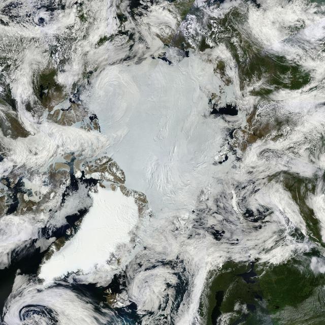
Dec 8, 2017
NASA Satellites See Santa's North Pole
All was well at the North Pole this summer, when Santa and his elves were busily making toys and taking orders for...
GSFC
Image
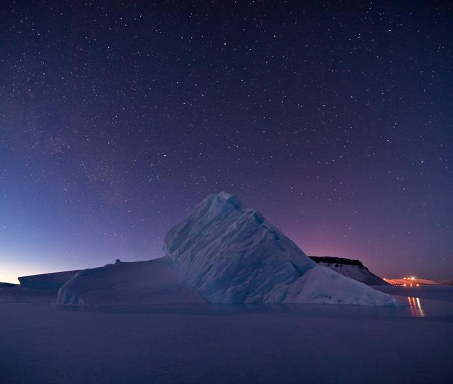
Dec 8, 2017
Iceberg in North Star Bay, Greenland
For five years, Jeremy Harbeck has worked as a support scientist for NASA’s Operation IceBridge, an airborne mission...
GSFC