Image
Dec 8, 2017
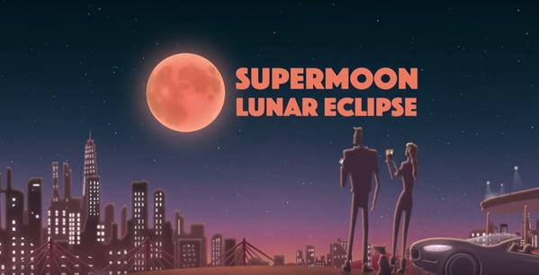
Super Blood Moon Lunar Eclipse
CLOUDY with a chance of NOT SEEING the Super Blood Moon Lunar Eclipse? WATCH Live here: bit.ly/1LfspfW No worries,...
GSFC
Image
Dec 8, 2017
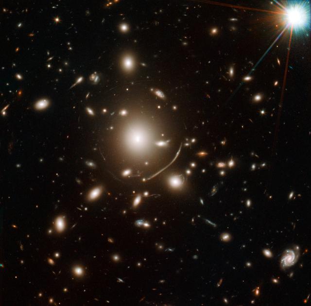
NASA Telescopes Help Discover Surprisingly Young Galaxy
NASA image release April 12, 2011 Astronomers have uncovered one of the youngest galaxies in the distant universe,...
GSFC
Image
May 14, 2002
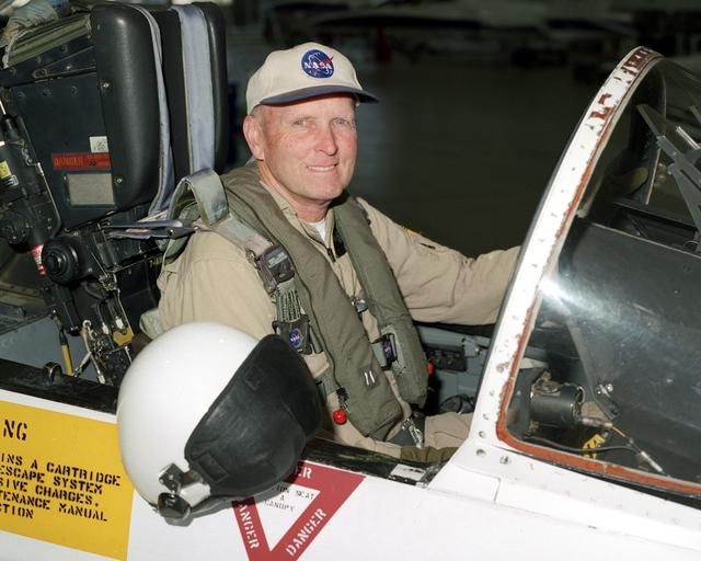
Research pilot and former astronaut C. Gordon Fullerton in an F/A-18
Former NASA astronaut C. Gordon Fullerton, seated in the cockpit of an F/A-18, is a research pilot at NASA's Dryden...
AFRC
Image
Dec 8, 2017
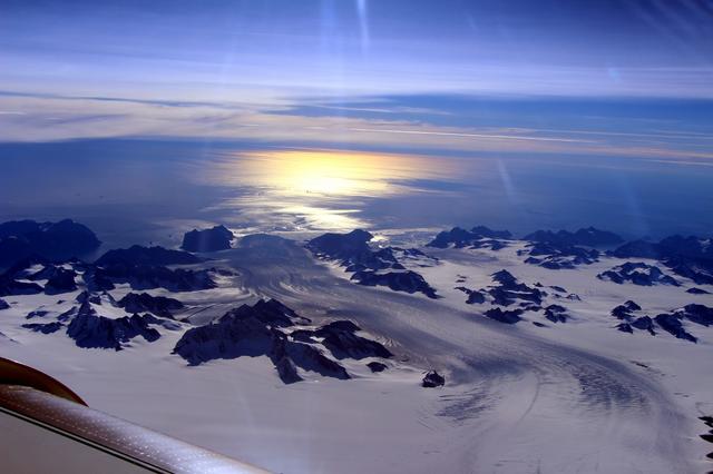
NASA's Observes Effects of Summer Melt on Greenland Ice Sheet
NASA's IceBridge, an airborne survey of polar ice, flew over the Helheim/Kangerdlugssuaq region of Greenland on...
GSFC
Image
Dec 8, 2017
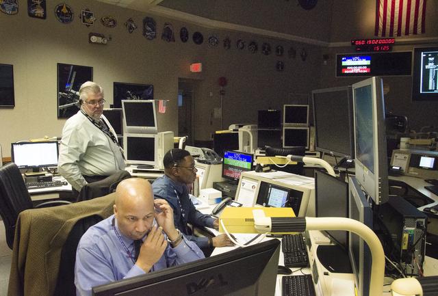
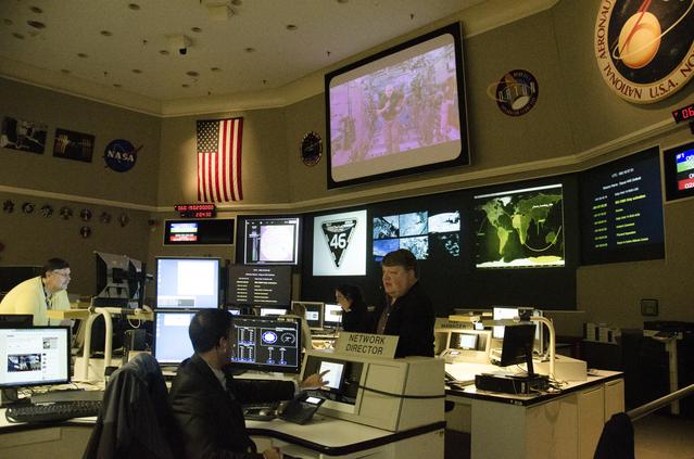
Ending Year in Space: NASA Goddard Network Maintains Communications from Space to Ground
NASA's Goddard Space Flight Center in Greenbelt, Maryland, will monitor the landing of NASA Astronaut Scott Kelly...
GSFC
Image
Dec 8, 2017
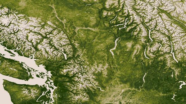
Pacific Northwest
The Rocky, Cascade, and Coast Mountain Ranges dominate the landscape of the Pacific Northwest in this image created...
GSFC
Image
Dec 8, 2017
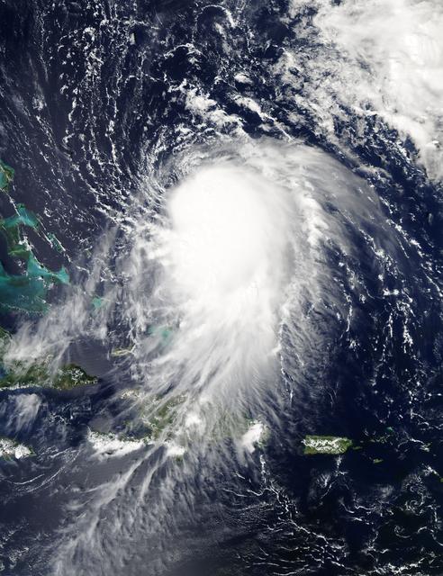
Hurricane Joaquin on 9/29/15
NASA's Aqua satellite captured this image of Joaquin near the Bahamas on Sept. 29 at 18:10 UTC (2:10 p.m. EDT)....
GSFC
Image
Dec 8, 2017
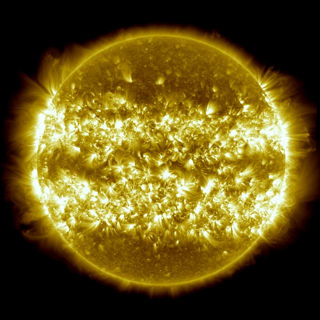
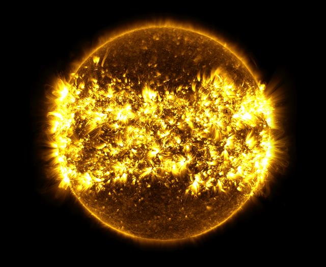
The Sun: One Year in One Image
Image released: April 22, 2013 In the three years since it first provided images of the sun in the spring of 2010,...
GSFC
Image
Dec 8, 2017
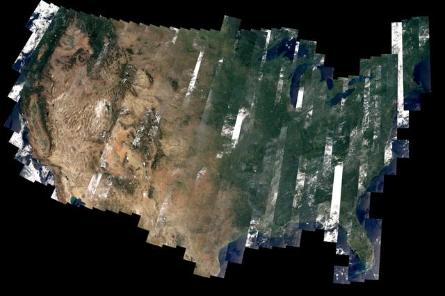
Landsat 8’s First Year
On February 11, 2013, the Landsat 8 satellite rocketed into a sunny California morning onboard a powerful Atlas V...
GSFC
Image
Dec 8, 2017
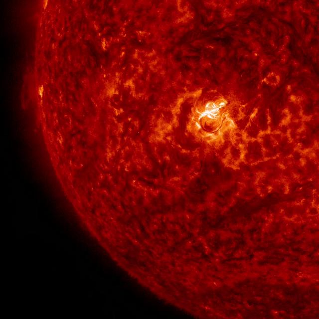
Sun Emits an X2.2 Flare
The sun emitted a significant solar flare, peaking at 12:22 p.m. EDT on March 11, 2015. NASA’s Solar Dynamics...
GSFC
Image
Dec 8, 2017
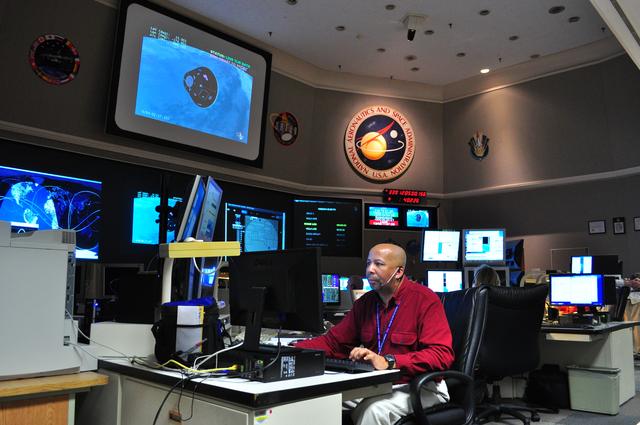
Goddard Monitors Orions EFT-1 Test Flight
NASA's Goddard Space Flight Center in Greenbelt, Maryland, played a critical role in the test flight of the #Orion...
GSFC
Image
Dec 8, 2017
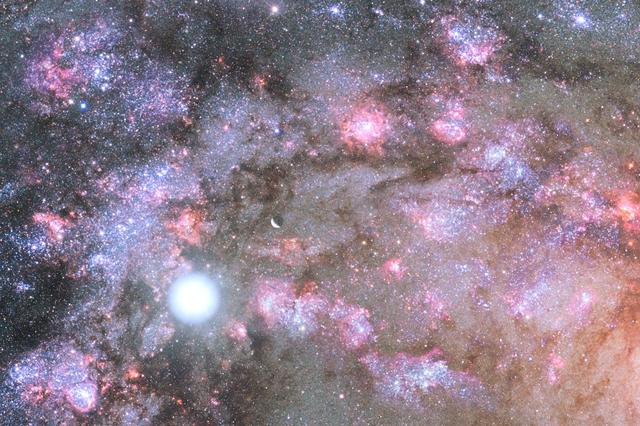
NASA Telescopes Uncover Early Construction of Giant Galaxy
Astronomers have for the first time caught a glimpse of the earliest stages of massive galaxy construction. The...
GSFC

Image
Dec 8, 2017
Typhoon Soudelor's Eye Close-Up from NASA-NOAA's Suomi NPP
On August 6, 2015, NASA-NOAA's Suomi NPP satellite passed over powerful Typhoon Soudelor when it was headed toward...
GSFC
Image
Dec 8, 2017
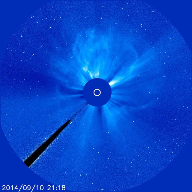
Earth-Directed X-Class Flare and CME
An active region just about squarely facing Earth erupted with an X 1.6 flare (largest class) as well as a coronal...
GSFC
Image
Dec 8, 2017
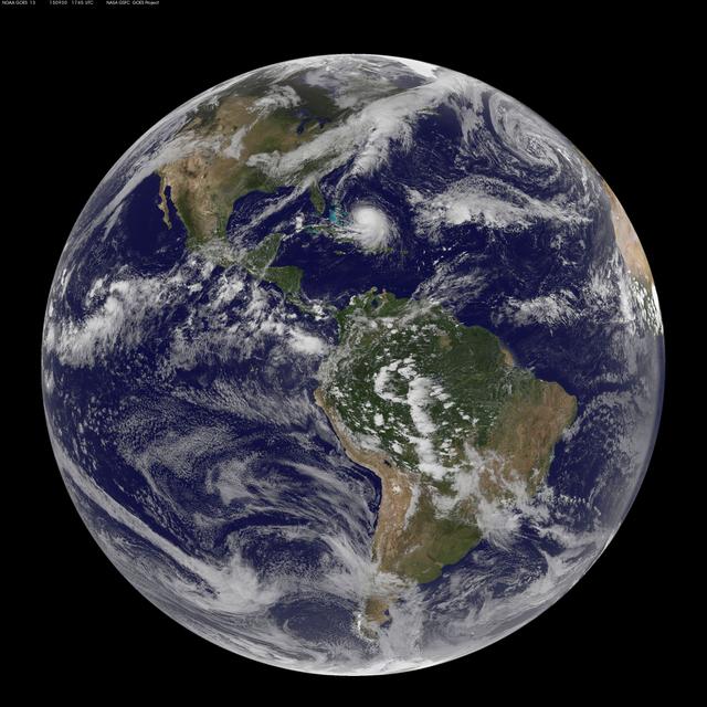
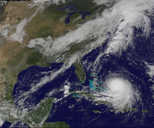
Hurricane Joaquin 9/30/15
NOAA's GOES-East satellite captured this visible image of Hurricane Joaquin east of the Bahamas on Sept. 30 at 1745...
GSFC
Image
Jun 5, 1958
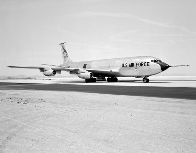
E-4123
The Boeing KC-135 Stratotanker, besides being used extensively in its primary role as an inflight aircraft refueler,...
AFRC
Image
Oct 16, 2024
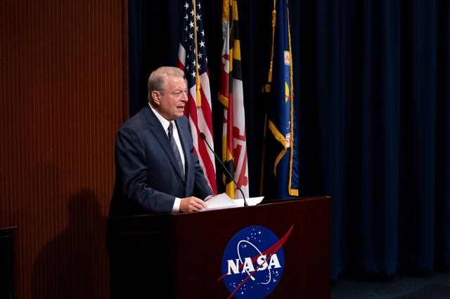
Former VP Al Gore at NASA Goddard
To commemorate the upcoming 10th anniversary of the DSCOVR (Deep Space Climate Observatory) mission, NASA’s Goddard...
GSFC
Image
Dec 8, 2017
Ending Year in Space: NASA Goddard Network Maintains Communications from Space to Ground
NASA's Goddard Space Flight Center in Greenbelt, Maryland, will monitor the landing of NASA Astronaut Scott Kelly...
GSFC

Image
Dec 8, 2017
Rare Ultra-blue Stars Found in Neighboring Galaxy's Hub
Image release January 11, 2012 A new Hubble Space Telescope image centers on the 100-million-solar-mass black hole...
GSFC
Image
Dec 8, 2017
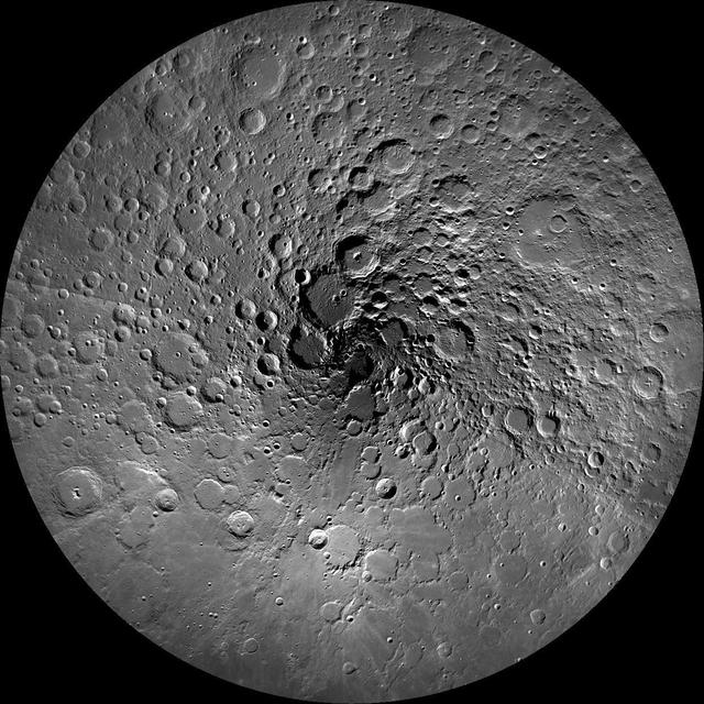
The Moon's North Pole
NASA image release September 7, 2011 The Earth's moon has been an endless source of fascination for humanity for...
GSFC
Image
Dec 8, 2017
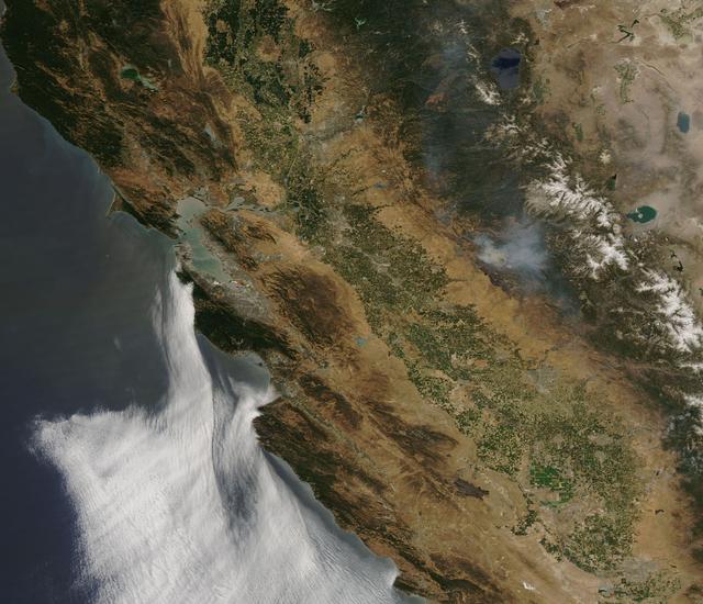
NASA Sees Smoke from California’s Long Valley Wildfire
NASA’s Aqua satellite captured a large area of smoke from the Long Valley Wildfire that was affecting Yosemite...
GSFC
Image
Dec 8, 2017
SDO: Year 6
This image, is a composite of 23 separate images spanning the period of January 11, 2015 to January 21, 2016. It...
GSFC
Image
Dec 8, 2017
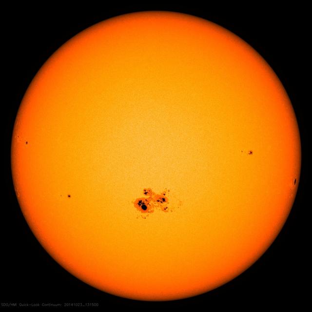
NASA's SDO Observes Largest Sunspot of the Solar Cycle
On Oct. 18, 2014, a sunspot rotated over the left side of the sun, and soon grew to be the largest active region...
GSFC
Image
Dec 8, 2017
Hurricane Joaquin 9/30/15
NOAA's GOES-East satellite captured this visible image of Hurricane Joaquin east of the Bahamas on Sept. 30 at 1745...
GSFC