Image
Dec 8, 2017
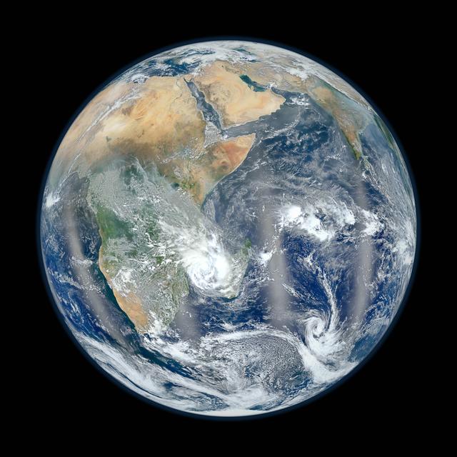
Eastern Hemisphere - Blue Marble 2012
February 2, 2012 Go here to view an image that explains how composite images like these are created:...
GSFC
Image
Dec 8, 2017
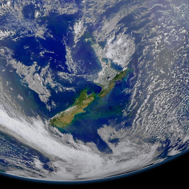
New Zealand
This image taken from the Suomi NPP satellite's VIIRS instrument of New Zealand was collected on January 9, 2015...
GSFC
Image
Dec 8, 2017
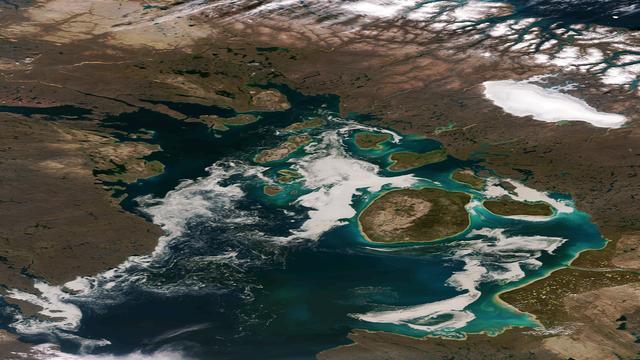
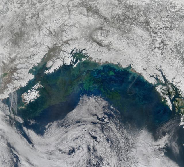
Sea Ice and Phytoplankton Mix in the Northwestern Passage
The remnants of sea ice along the Northwestern Passage in northern Canada are seen swirling with the blue green of...
GSFC
Image
Dec 8, 2017
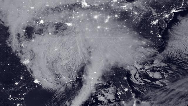
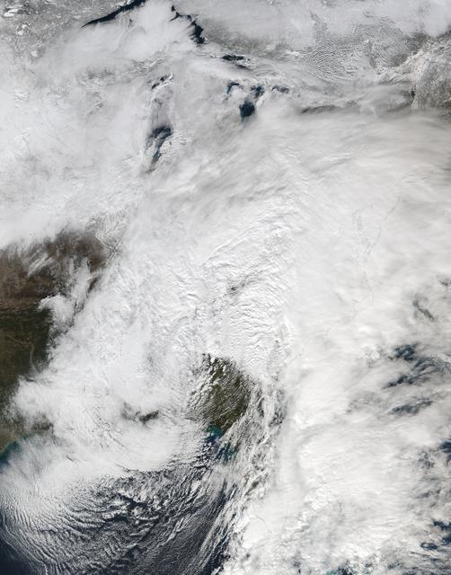
Blizzard Bears Down on U.S. East Coast
NASA and NOAA satellites are tracking the large winter storm that is expected to bring heavy snowfall to the U.S....
GSFC

Image
Dec 8, 2017
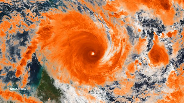
Typhoon Champi Develops Massive Eye
Taken on October 22, 2015 at 0400 UTC by the Suomi NPP satellite's VIIRS sensor, this colorized infrared image shows...
GSFC
Image
Dec 8, 2017
Gulf of Alaska
The spring bloom in the Gulf of Alaska was well underway on April 12, 2017, when the Aqua/MODIS and Suomi-NPP/VIIRS...
GSFC
Image
Dec 8, 2017
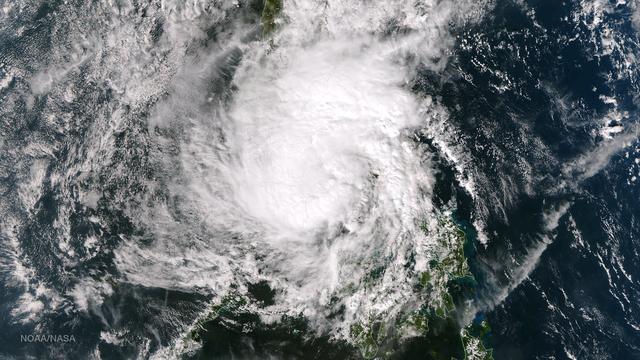
Tropical Cyclone Ita Off-Shore Queensland, Australia
Residents of the northeast coast of Queensland, Australia are facing high winds, dangerous tides and very heavy rain...
GSFC
Image
Dec 8, 2017
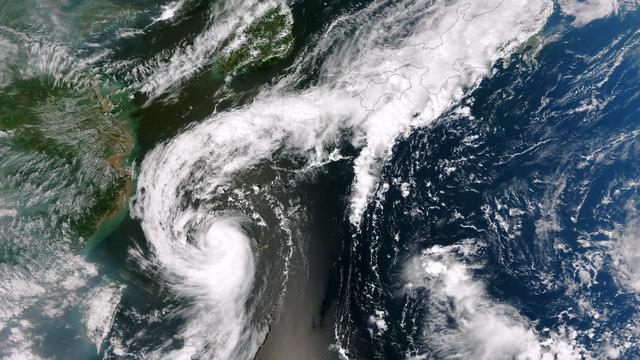
Tropical Storm Toraji Spawns Tornadoes in Japan
The outflow from Tropical Storm Toraji spawned tornadoes that caused injuries and property damage in Koshigaya,...
GSFC
Image
Dec 8, 2017
Winter storm over the eastern United States
NASA-NOAA's Suomi NPP satellite passed over the large low pressure area on January 22 at 1855 UTC (1:55 p.m. EST)...
GSFC
Image
Dec 8, 2017
Tropical Storm Hagupit Weakening as it Nears Manila
Tropical Storm Hagupit's low level circulation center is being obscured by its deep central convection and...
GSFC
Image
Dec 8, 2017
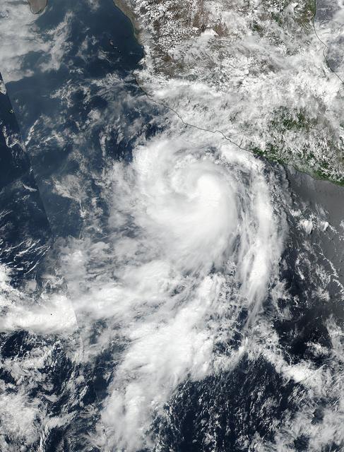
NASA Sees Quick Development of Hurricane Dora
The fourth tropical cyclone of the Eastern Pacific Ocean season formed on June 25 and by June 26 it was already a...
GSFC
Image
Dec 8, 2017
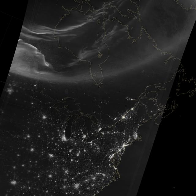
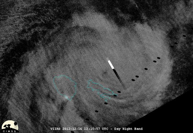
Aurora over North America
Using the “day-night band” (DNB) of the Visible Infrared Imaging Radiometer Suite (VIIRS), the Suomi National...
GSFC
Image
Dec 8, 2017
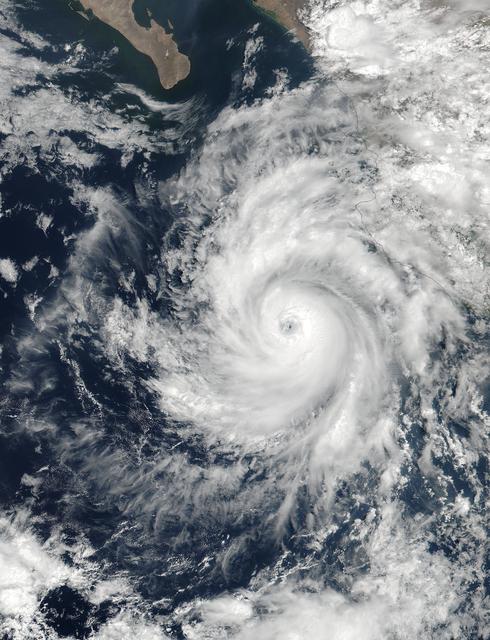
NASA Captures Hurricane Dora at Peak Strength, Before Weakening Began
At 19:36 UTC (3:36 p.m. EDT) on June 26, the Visible Infrared Imaging Radiometer Suite (VIIRS) instrument aboard...
GSFC

Image
Dec 8, 2017
Lightning Flashes and Gravity Waves in Tropical Cyclone Mahasen
Tropical Cyclone Mahasen is moving north through the Indian Ocean along a track that places landfall along the...
GSFC
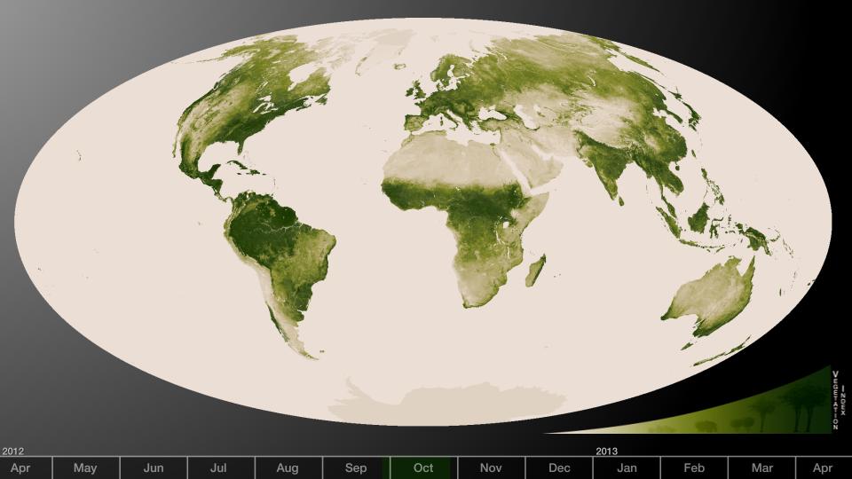
Image
Dec 8, 2017
Herbal Earth
Subtle vegetation changes are visible in this year-long visualization. Large-scale patterns vary with seasons, but...
GSFC

Image
Dec 8, 2017
Typhoon Soudelor's Eye Close-Up from NASA-NOAA's Suomi NPP
On August 6, 2015, NASA-NOAA's Suomi NPP satellite passed over powerful Typhoon Soudelor when it was headed toward...
GSFC

Image
Dec 8, 2017
A Night-time Look at Typhoon Soudelor from NASA-NOAA's Suomi NPP Satellite
On August 6, 2015, NASA-NOAA's Suomi NPP satellite passed over powerful Typhoon Soudelor at night when it was headed...
GSFC
Image
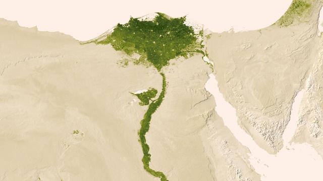
Dec 8, 2017
Nile Delta
Urbanized areas of northern Egypt are visible amidst the deserts of Egypt. The image captured July 9-15, 2012 also...
GSFC
Image
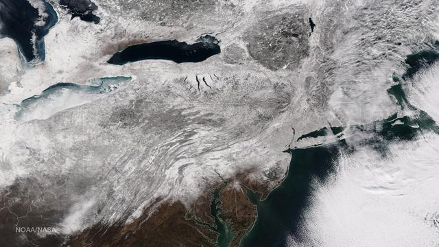
Dec 8, 2017
Blizzard Blankets the Northeast With Snow
As the storm moves offshore and the skies clear over the Northeast United States, the extent of snowfall from the...
GSFC
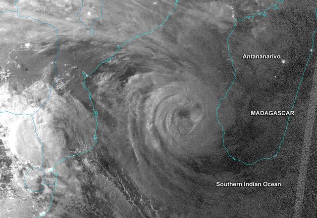
Image
Dec 8, 2017
NASA-NOAA's Suomi NPP Satellite Cyclone Haruna Near Madagascar at Night
This night-time image revealed Cyclone Haruna's massive eye before it made landfall in southwestern Madagascar. This...
GSFC
Image
Dec 8, 2017
NASA/NOAA's Suomi NPP Satellite's Night-time View of Cyclone Evan
This night-time view of Cyclone Evan was taken from the Visible Infrared Imaging Radiometer Suite (VIIRS) on...
GSFC

Image
Dec 8, 2017
NASA-NOAA's Suomi NPP Gets an Infrared look at Typhoon Soudelor
On August 6, 2015, NASA-NOAA's Suomi NPP satellite passed over powerful Typhoon Soudelor when it was headed toward...
GSFC
Image
Dec 8, 2017
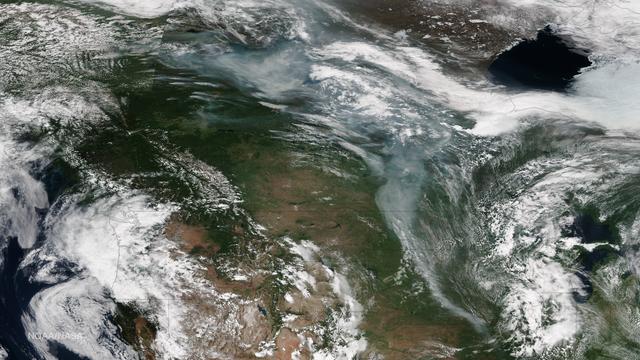
Smoke from Alaska and Canada Fires Dives into the Continental U.S.
The InciWeb Incident Information System is following 18 fires in Alaska that are contributing, along with 49...
GSFC
Image
Dec 8, 2017
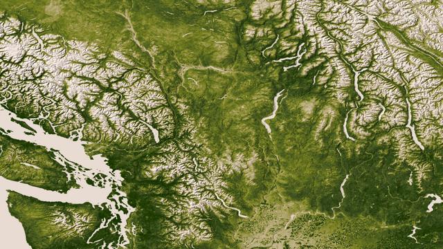
Pacific Northwest
The Rocky, Cascade, and Coast Mountain Ranges dominate the landscape of the Pacific Northwest in this image created...
GSFC