Video
Mar 22, 2018
New NASA Model Finds Landslide Threats in Near Real-Time During Heavy Rains
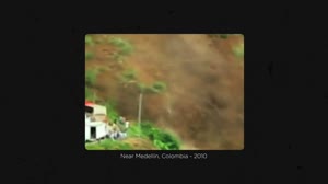
A new model has been developed to look at how potential landslide activity is changing around the world. A global...
GSFC
Video
Mar 22, 2018
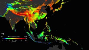
NASA Landslide Model: Southeast Asia
A new model has been developed to look at how potential landslide activity is changing around the world. A global...
GSFC
Video
Mar 22, 2018
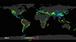
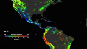
NASA Landslide Model: Global
A new model has been developed to look at how potential landslide activity is changing around the world. A global...
GSFC
Video
Mar 22, 2018
NASA Landslide Model: Global 2
A new model has been developed to look at how potential landslide activity is changing around the world. A global...
GSFC
Video
Mar 22, 2018
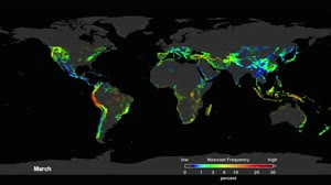
NASA Landslide Model: Americas
A new model has been developed to look at how potential landslide activity is changing around the world. A global...
GSFC
Image
Sep 17, 2011
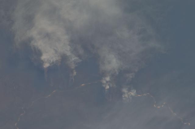
Earth observation taken by the Expedition 29 crew
ISS029-E-008032 (17 Sept. 2011) --- Fires along the Rio Xingu, Brazil are featured in this image photographed by an...
JSC
Image
Aug 5, 1973
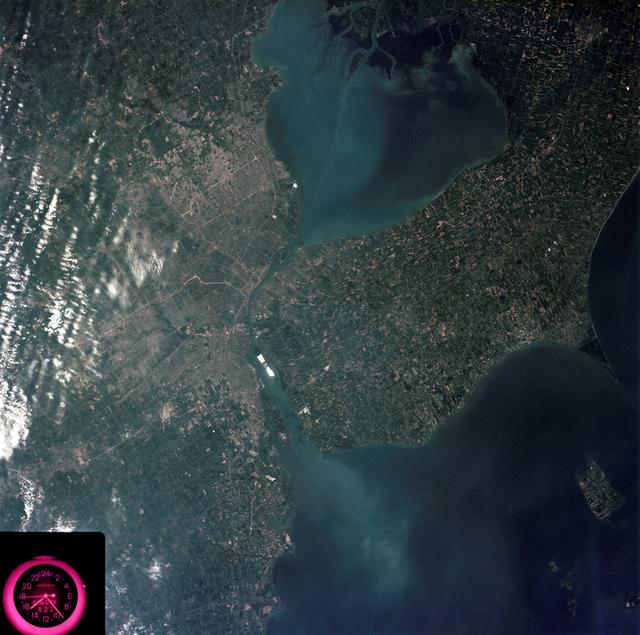
Detroit, Michigan metropolitan area photographed from Skylab
SL3-83-0152 (July-September 1973) --- A near vertical view of the metropolitan Detroit, Michigan area is seen in...
JSC
Image
Sep 15, 2022
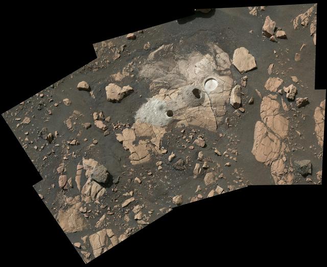
Sample Collection and Rock Analysis at Wildcat Ridge
Composed of multiple images from NASA's Perseverance Mars rover, this mosaic shows a rocky outcrop called "Wildcat...
JPL
Image
Dec 8, 2017
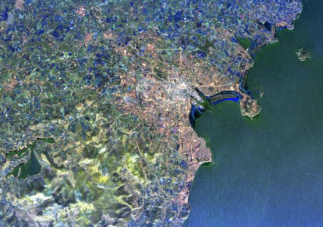
Radar Image of Dublin, Ireland
Visualization Date 1994-04-11 This radar image of Dublin, Ireland, shows how the radar distingishes between densely...
GSFC
Image
Dec 8, 2017
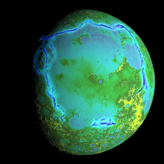
Topography of Earth's moon
Topography of Earth's moon generated from data collected by the Lunar Orbiter Laser Altimeter, aboard NASA's Lunar...
GSFC
Image
Sep 15, 2022
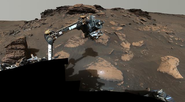
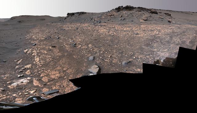
Perseverance Workspace at Skinner Ridge
NASA's Perseverance rover puts its robotic arm to work around a rocky outcrop called "Skinner Ridge" in Mars' Jezero...
JPL
Image
Dec 8, 2017
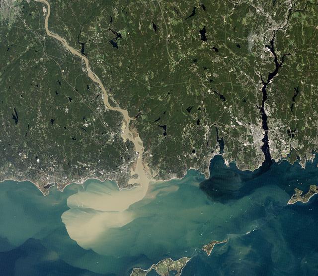
Sediment Spews from Connecticut River
NASA image acquired September 2, 2011 To download the full high res go to:...
GSFC
Image
Sep 14, 2022
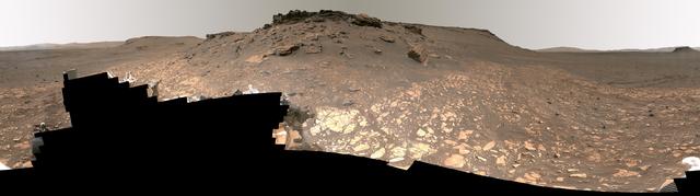
Detailed Panorama of Mars' Jezero Crater Delta
Intriguing Martian rocks surround NASA's Perseverance rover in this panorama showing an ancient river delta, made...
JPL
Image
Sep 15, 2022
2 Perseverance Sampling Locations in Jezero's Delta
This image shows two locations in Mars's Jezero Crater where NASA's Perseverance rover collected rock samples for...
JPL
![NASA image: Extensive Ice Fractures in the Beaufort Sea [detail]](https://images-assets.nasa.gov/image/GSFC_20171208_Archive_e001526/GSFC_20171208_Archive_e001526~thumb.jpg)
Image
Dec 8, 2017
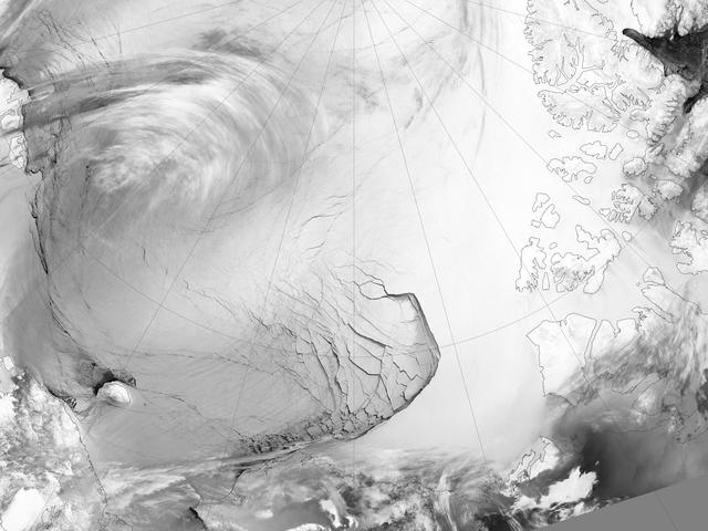
Extensive Ice Fractures in the Beaufort Sea [detail]
The Visible Infrared Imaging Radiometer Suite (VIIRS) on the Suomi NPP satellite captured this view of extensive...
GSFC
Image
Dec 8, 2017
Extensive Ice Fractures in the Beaufort Sea
The Visible Infrared Imaging Radiometer Suite (VIIRS) on the Suomi NPP satellite captured this view of extensive...
GSFC
![NASA image: Extensive Ice Fractures in the Beaufort Sea [annotated]](https://images-assets.nasa.gov/image/GSFC_20171208_Archive_e001524/GSFC_20171208_Archive_e001524~thumb.jpg)
Image
Dec 8, 2017
Extensive Ice Fractures in the Beaufort Sea [annotated]
The Visible Infrared Imaging Radiometer Suite (VIIRS) on the Suomi NPP satellite captured this view of extensive...
GSFC
Image
Dec 8, 2017
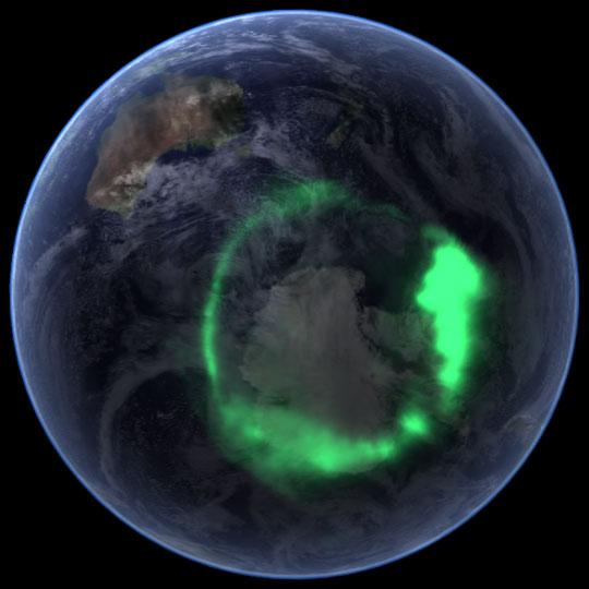
NASA's IMAGE Spacecraft View of Aurora Australis from Space
NASA file image acquired September 11, 2005 To view a video of this event go here:...
GSFC
Image
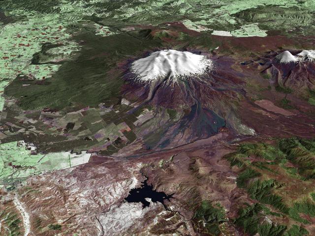
Dec 8, 2017
Mt. Ruapehu, New Zealand
All around the world, people live in places where the threat of natural disaster is high. On the North Island of New...
GSFC
Video
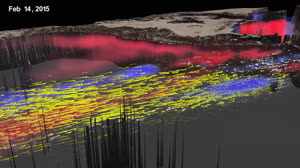
May 26, 2017
A 3D Look at the 2015 El Niño
El Niño is a recurring climate pattern characterized by warmer than usual ocean temperatures in the equatorial...
GSFC

Video
Mar 19, 2018
Harmonized Landsat 8 and Sentinel-2 Data: Columbus Nebraska
Landsat 8 and Sentinel-2 satellites have spectral and spatial similarities that make using their data together...
GSFC
Audio
May 23, 2025
Ep386_Moon_Material_Flammability
Ep386_Moon Material Flammability Gary Jordan Houston, we have a podcast. Welcome to the official podcast of the NASA...
JSC
Audio
Sep 12, 2025
Ep401_Artemis_II_Launch
Ep401_Artemis II Launch Joseph Zakrzewski Houston We Have a Podcast. Welcome to the official podcast of the NASA...
JSC
Audio
Mar 20, 2026
HWHAP Ep416 Bringing The Mission To You
Ep416_Bringing The Mission To You Joseph Zakrzewski Houston We Have a Podcast. Welcome to the official podcast of...
JSC