Image
Feb 1, 2012
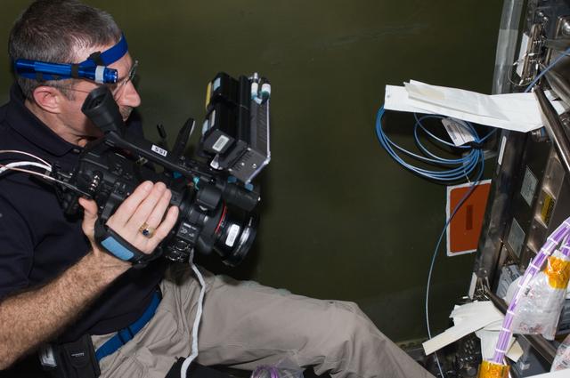
Burbank uses video camera during installation and routing of HRCS Video Cables
ISS030-E-060104 (1 Feb. 2012) --- NASA astronaut Dan Burbank, Expedition 30 commander, uses a video camera in the...
JSC
Image
Feb 1, 2012
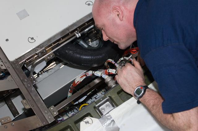
Kuipers installs and routes RCS Video Cables in the U.S. Laboratory
ISS030-E-060117 (1 Feb. 2012) --- In the International Space Station?s Destiny laboratory, European Space Agency...
JSC
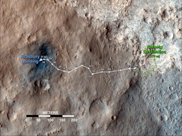
Image
Sep 19, 2012
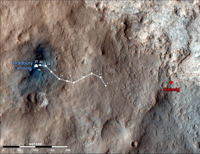
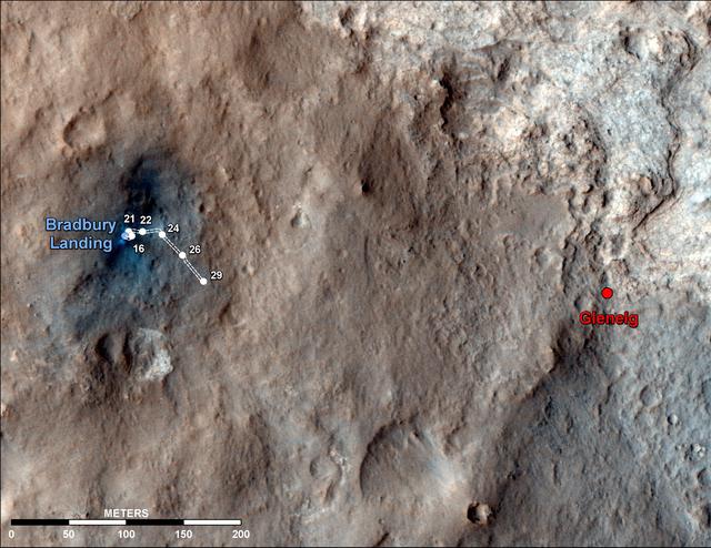
Curiosity Traverse Map Through Sol 43
This map shows the route driven by NASA Mars rover Curiosity through the 43rd Martian day, or sol, of the rover...
JPL
Image
Jun 23, 2014
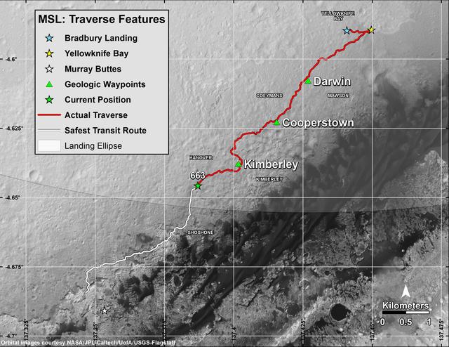
Curiosity Rover Traverse, First 663 Sols on Mars
This map shows in red the route driven by NASA Curiosity Mars rover from its landing site at Bradbury Landing. The...
JPL
Image
Apr 19, 2011
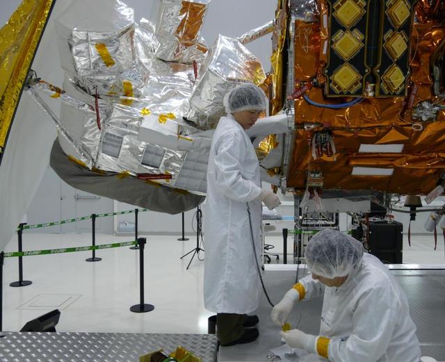
Thermal Blanket Check
Completion of the thermal blanket patterns for the Aquarius bipod after routing the flight harness from the SAC-D...
JPL
Image
May 22, 2008
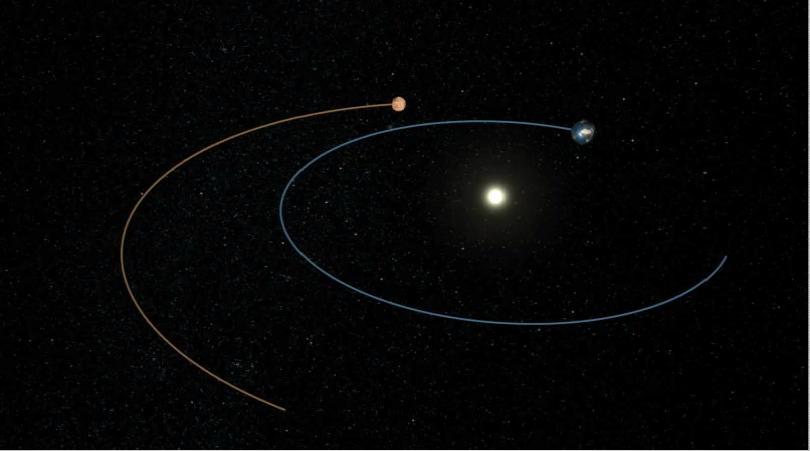
Phoenix Path to Mars Artist Concept
This artist animation shows the route NASA Phoenix Mars Lander took to get from Earth to Mars.
JPL
Image
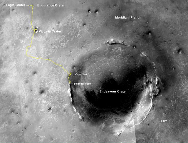
Dec 3, 2013
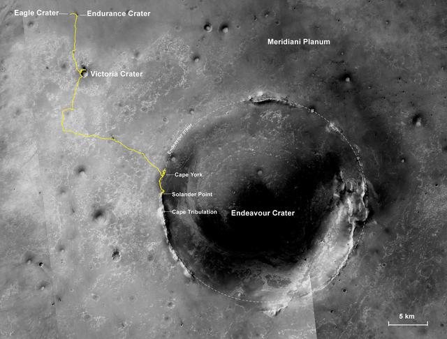
Opportunity Journey, Approaching 10th Anniversary
The gold line on this image shows NASA Mars Exploration Rover Opportunity route as it investigating on the western...
JPL
Image
Dec 8, 2014
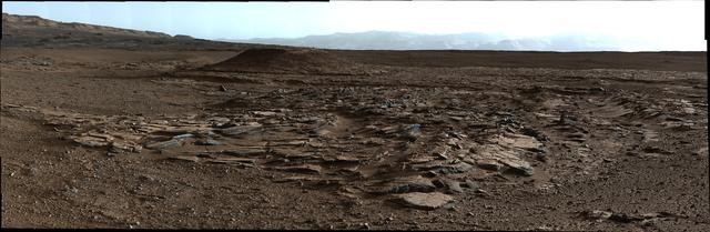
Sets of Beds Inclined Toward Mount Sharp
This image from Curiosity Mastcam looks to the west of a waypoint on the rover route to Mount Sharp. The mountain...
JPL
Image
Dec 17, 2015
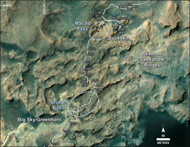
Curiosity Path During 2015 Studies of Silica-Rich Rocks
This map shows the route on lower Mount Sharp that NASA Curiosity followed between April 19, 2015, and Nov. 5, 2015.
JPL
Image
Sep 28, 2022
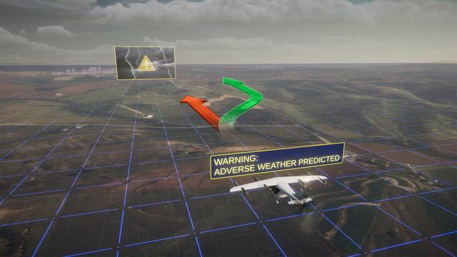
Ensuring Safety for Advanced Air Mobility
NASA's Advanced Air Mobility mission is helping to ensure this new class of aircraft that industry is developing is...
HQ

Image
Sep 11, 2008
Recent State of Arctic Sea Ice
There has been considerable interest in the recent state of Arctic sea ice for scientific research and for...
JPL
Image
Dec 17, 2015
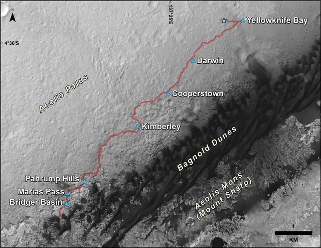
Curiosity Rover Traverse, First 1,185 Sols on Mars
This map shows the route driven by NASA Curiosity Mars rover from the location where it landed in August 2012 to its...
JPL
Image
Sep 6, 2012
Curiosity Traverse Map Through Sol 29
This map shows the route driven by NASA Mars rover Curiosity through the 29th Martian day, or sol, of the rover...
JPL
Image
Oct 4, 2012
Curiosity Travels Through Sol 56
This map shows the route driven by NASA Mars rover Curiosity through the 56th Martian day, or sol, of the rover...
JPL
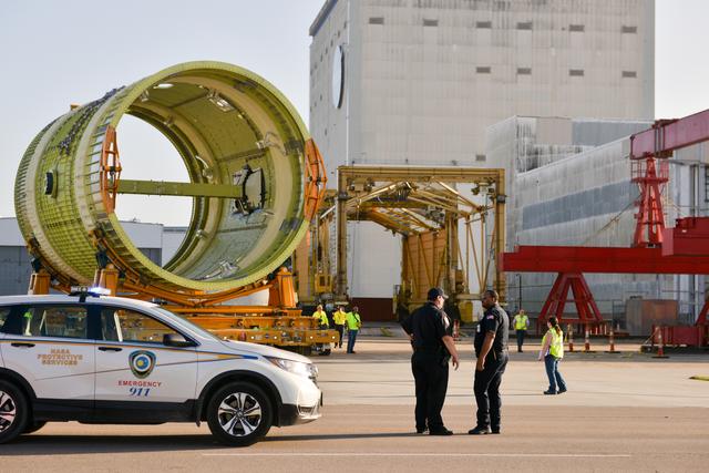
Image
Feb 22, 2018
Michoud Protective Services supports the Intertank STA move.
Intertank STA en route to Pegasus, while the Michoud Protective Services guides the route.
MAF
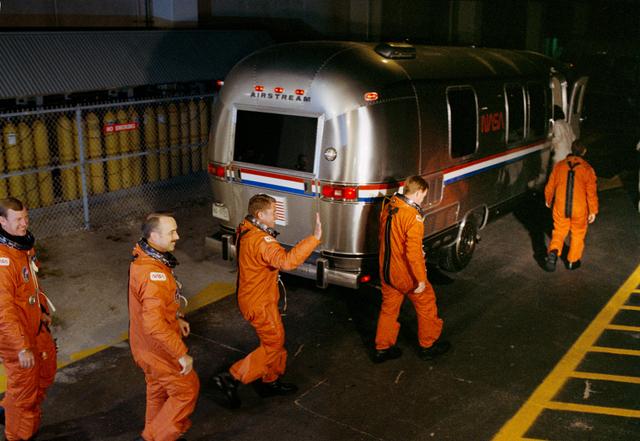
Image
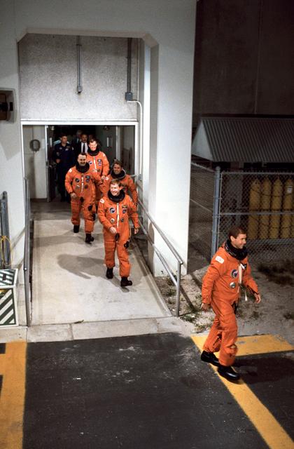
Aug 8, 1989
STS-28 Columbia, OV-102, crewmembers leave KSC O&C Bldg en route to LC Pad 39
STS028-S-002 (8 Aug 1989) --- The five astronaut crewmembers for STS-28 leave the Operations and Checkout (O&C)...
JSC
Image
Mar 29, 2024
Curiosity's Route to Gediz Vallis Channel (Rendering)
This rendering shows the area where NASA's Curiosity Mars rover climbed a steep slope to reach a location called...
JPL
Image
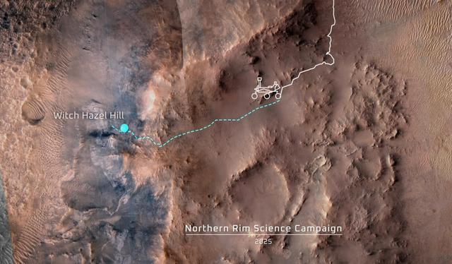
Dec 12, 2024
Proposed Route of Perseverance's Northern Rim Science Campaign
This animation shows the position of NASA's Perseverance Mars rover as of Dec. 4, 2024, the 1,347th Martian day, or...
JPL
Image
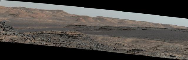
Nov 16, 2015
Curiosity Rover Will Study Dunes on Route up Mountain
This view from the Mast Camera (Mastcam) on NASA's Curiosity Mars rover shows a dark sand dune in the middle...
JPL
Image
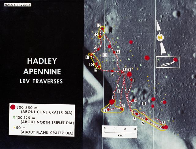
Jan 1, 1971
Lunar Orbiter - Lunar Roving Vehicle (LRV) Traverse Routes - Overlaid on Landing Site
S71-02254 (June 1971) --- An enlarged Lunar Orbiter photograph showing the Lunar Roving Vehicle (LRV) traverse...
JSC
Image
Aug 8, 1989
STS-28 Columbia, OV-102, crewmembers leave KSC O&C Bldg en route to LC Pad 39
STS028-S-001 (8 Aug 1989) --- The five astronaut crewmembers for STS-28 leave the operations and checkout building...
JSC
Image
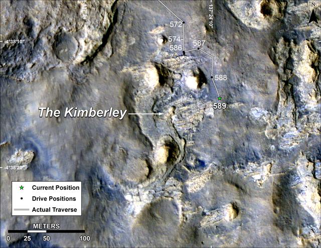
Apr 3, 2014
Map of Curiosity Mars Rover Drives to the Kimberley Waypoint
This map shows the route driven by NASA Curiosity Mars in its approach to and April 1, 2014, arrival at a waypoint...
JPL
Image
Oct 5, 2009
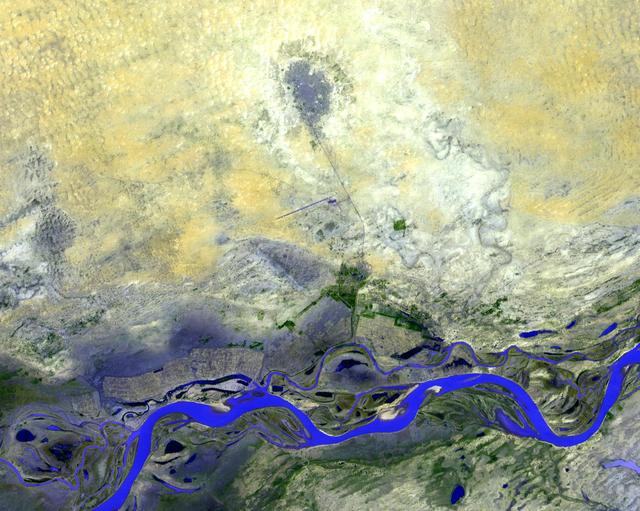
Timbuktu, Mali
NASA Terra spacecraft shows Timbuktu in the West African Nation of Mali, about 15 km north of the Niger River, at...
JPL
Image
Jan 23, 2014
Opportunity First Decade of Driving on Mars
The gold line on this image shows NASA Opportunity route from the landing site, in upper left, to the area it is...
JPL