
Video
Apr 8, 2021
NASA’s CAMP2Ex: Cloud, Aerosol, and Monsoonal Processes-Philippines Experiment
The Cloud, Aerosol, and Monsoonal Processes-Philippines Experiment, or CAMP2Ex, involved collaborators from...
ARC
Image
Aug 20, 2012
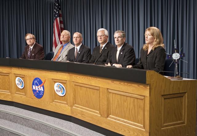
KSC-2012-4545
CAPE CANAVERAL, Fla. - A prelaunch news conference was held at NASA Kennedy Space Center’s Press Site in Florida for...
KSC
Image
Aug 20, 2012
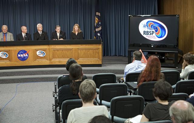
KSC-2012-4546
CAPE CANAVERAL, Fla. -- A prelaunch news conference is held at NASA Kennedy Space Center’s Press Site in Florida for...
KSC
Image
Jun 9, 2008
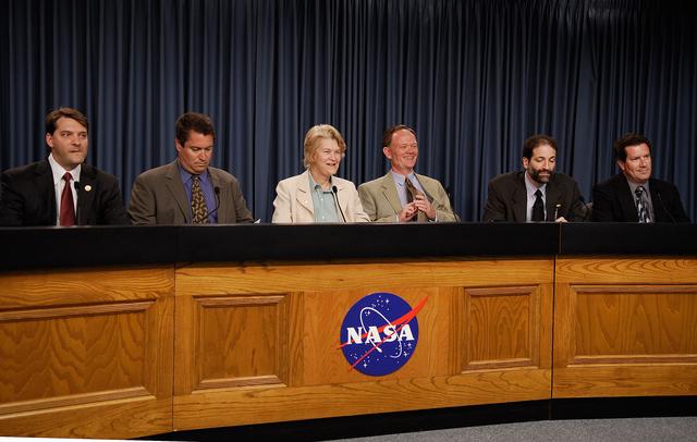
KSC-08pd1603
CAPE CANAVERAL, Fla. -- At NASA's Kennedy Space Center, key personnel brief the media on NASA's Gamma-Ray Large Area...
KSC
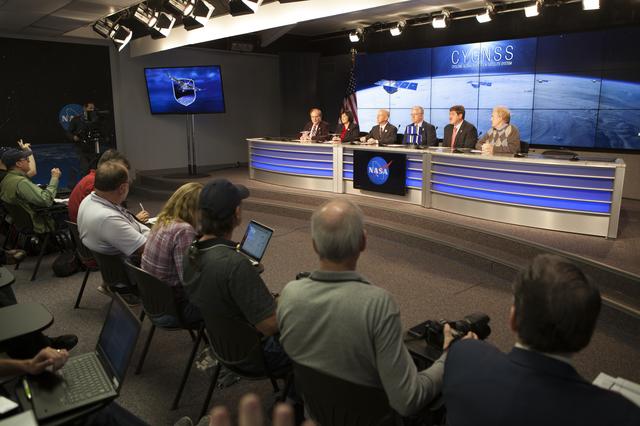
Image
Dec 10, 2016
Pegasus XL CYGNSS Prelaunch News Conference
In the Kennedy Space Center’s Press Site auditorium, NASA and industry leaders speak to members of the media during...
KSC
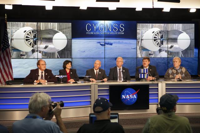
Image
Dec 10, 2016
Pegasus XL CYGNSS Prelaunch News Conference
In the Kennedy Space Center’s Press Site auditorium, NASA and industry leaders speak to members of the media during...
KSC
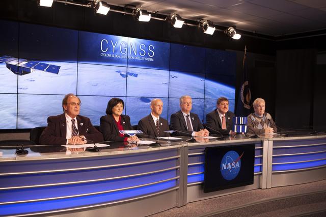
Image
Dec 10, 2016
Pegasus XL CYGNSS Prelaunch News Conference
In the Kennedy Space Center’s Press Site auditorium, NASA and industry leaders speak to members of the media during...
KSC
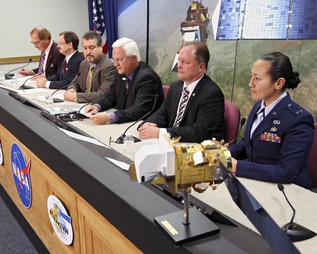
Image
Dec 10, 2016
Pegasus XL CYGNSS Prelaunch News Conference
In the Kennedy Space Center’s Press Site auditorium, NASA and industry leaders speak to members of the media during...
KSC
Image
Feb 8, 2013
KSC-2013-1417
VANDENBERG AIR FORCE BASE, Calif. -- Media attend a prelaunch press conference at Vandenberg Air Force Base in...
KSC
Image
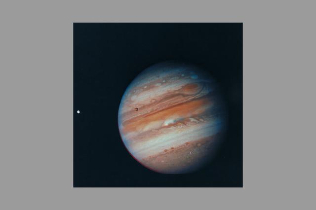
Feb 5, 1979
ARC-1969-AC79-0164-2
Photo by Voyager 1 (JPL) Jupiter, its Great Red Spot and three of its four largest satellites are visible in this...
ARC
Image
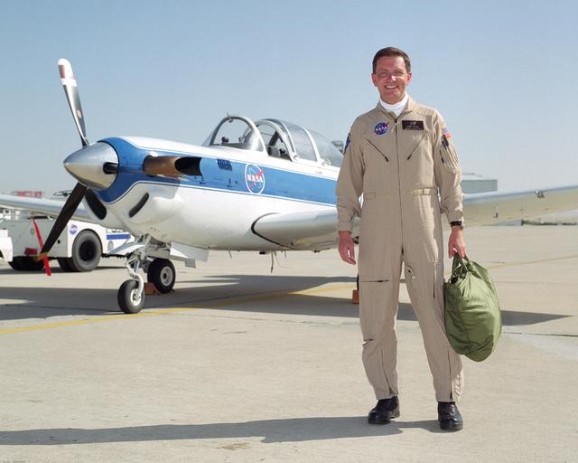
Apr 16, 2001
Research pilot Mark Pestana
Mark Pestana is a research pilot and project manager at the NASA Dryden Flight Research Center, Edwards, Calif. He...
AFRC
Image
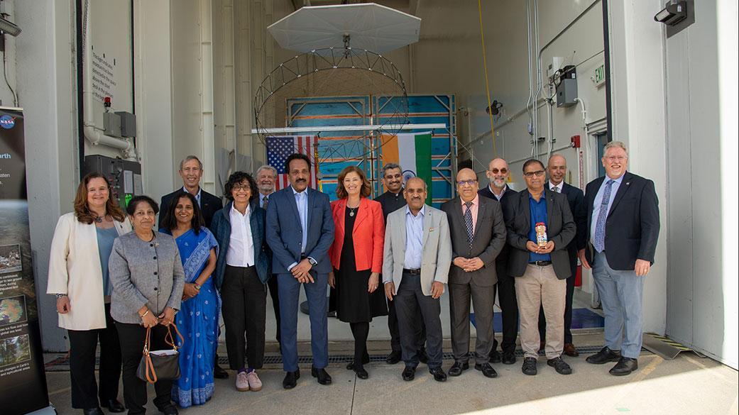
Feb 3, 2023
NASA, JPL, ISRO, and Indian Embassy Officials Send Off NISAR
Officials from NASA, the Indian Space Research Organization (ISRO), and the Embassy of India hold a send-off...
JPL
Image
Dec 8, 2017
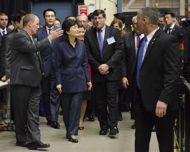
President Park Geun-hye of South Korea Visits NASA Goddard
President Park Geun-hye of South Korea and Center Director Christopher Scolese are greeted by Frank Cepollina,...
GSFC
Image
Dec 8, 2017
President Park Geun-hye of South Korea Visits NASA Goddard
Caption: President Park Geun-hye of South Korea and Center Director Christopher Scolese are greeted by Frank...
GSFC
Video
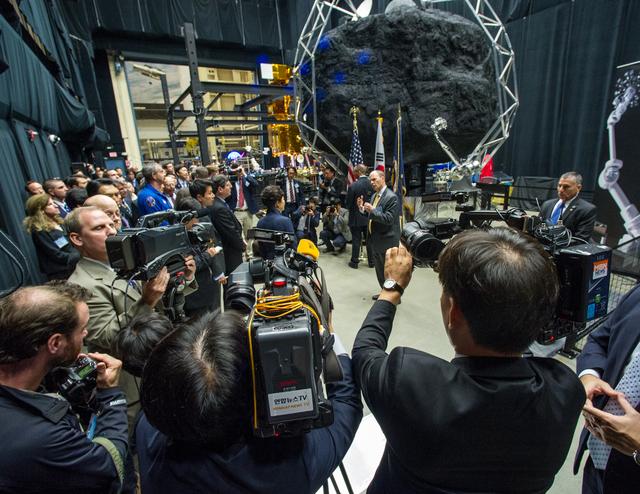
Oct 11, 2023
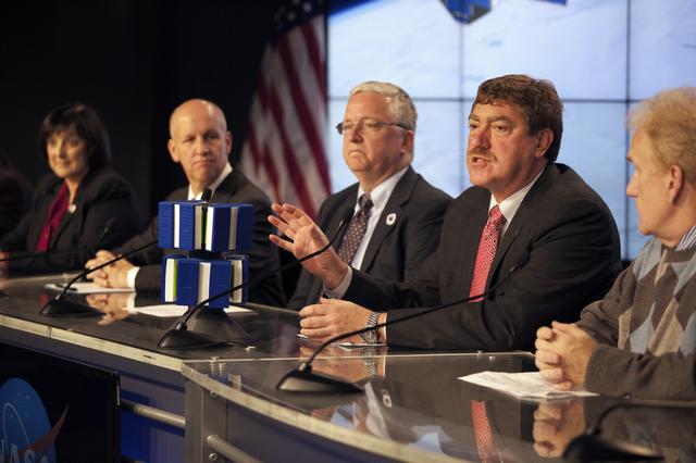
Psyche Prelaunch News Conference
The Prelaunch News Conference ahead of launch for NASA’s Psyche spacecraft, a mission to a unique metal-rich...
KSC
Image
Mar 23, 2000
Jupiter Ring
First evidence of a ring around the planet Jupiter is seen in this photograph taken by Voyager 1 on March 4, 1979....
JPL
Image
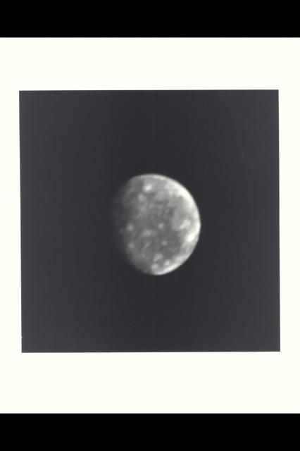
Feb 28, 1979
ARC-1979-A79-7027
This photo of Callisto, outermost of Jupiter's four Galilean satellites, was taken a few minutes after midnight...
ARC
Image
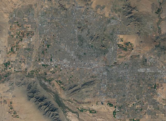
Dec 8, 2017
NASA Satellite Captures Super Bowl Cities - Phoenix
Landsat 7 image of Phoenix, Arizona acquired November 28, 2014. Landsat 7 is a U.S. satellite used to acquire...
GSFC
![NASA image: NASA Satellite Captures Super Bowl Cities - Phoenix [annotated]](https://images-assets.nasa.gov/image/GSFC_20171208_Archive_e000803/GSFC_20171208_Archive_e000803~thumb.jpg)
Image
Dec 8, 2017
NASA Satellite Captures Super Bowl Cities - Phoenix [annotated]
Landsat 7 image of Phoenix, Arizona acquired November 28, 2014. Landsat 7 is a U.S. satellite used to acquire...
GSFC
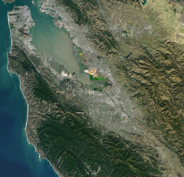
Image
Dec 8, 2017
NASA Satellite Captures Super Bowl Cities - Santa Clara, CA
Landsat 7 image of the Santa Clara area acquired Nov 16, 2015. Landsat 7 is a U.S. satellite used to acquire...
GSFC
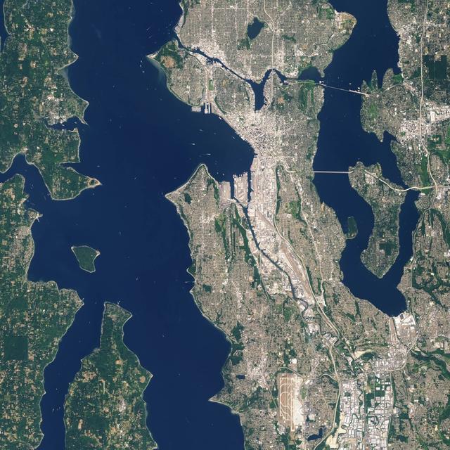
Image
Dec 8, 2017
NASA Satellite Captures Super Bowl Cities - Seattle
Landsat 7 image of Seattle, Washington acquired August 23, 2014. Landsat 7 is a U.S. satellite used to acquire...
GSFC
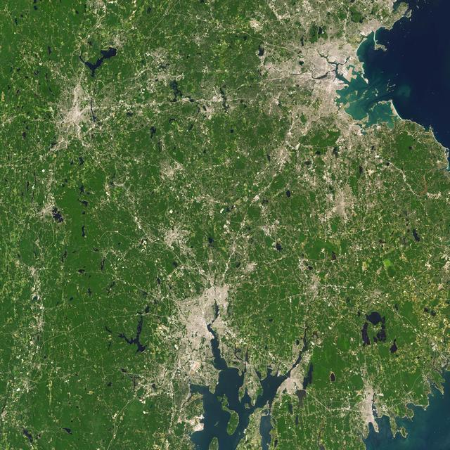
Image
Dec 8, 2017
NASA Satellite Captures Super Bowl Cities - Boston/Providence
Landsat 7 image of Boston/Providence area acquired August 25, 2014. Landsat 7 is a U.S. satellite used to acquire...
GSFC
Image
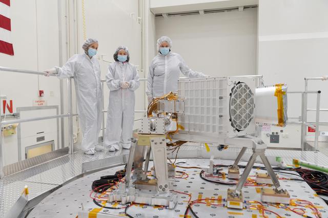
Jun 1, 2022
EMIT Put to the Test at JPL
Diane Hope, Charlene Ung, and Cathryn Murray-Wooddell oversee preparations for vibration testing of the Earth...
JPL

Image
Dec 8, 2017
NASA Satellite Captures Super Bowl Cities - Charlotte, NC
Landsat 7 image of the Charlotte, NC area acquired Oct 18, 2015. Landsat 7 is a U.S. satellite used to acquire...
GSFC