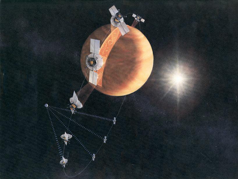
Magellan Orbit Artist Concept
An artist's concept of the Magellan spacecraft making a radar map of Venus. Magellan mapped 98 percent of Venus' surface at a resolution of 100 to 150 meters (about the length of a football or soccer field), using synthetic aperture radar, a technique that simulates the use of a much larger radar antenna. It found that 85 percent of the surface is covered with volcanic flows and showed evidence of tectonic movement, turbulent surface winds, lava channels and pancake-shaped domes. Magellan also produced high-resolution gravity data for 95 percent of the planet and tested a new maneuvering technique called aerobraking, using atmospheric drag to adjust its orbit. The spacecraft was commanded to plunge into Venus' atmosphere in 1994 as part of a final experiment to gather atmospheric data. http://photojournal.jpl.nasa.gov/catalog/PIA18175
Usage Rights
Most NASA images are in the public domain and free to use. Credit NASA as the source. Check NASA's media usage guidelines for details. Images featuring identifiable individuals may require additional permissions.
Keywords
Details
NASA ID
PIA18175
Date Created
August 10, 1990
Center
JPL
Media Type
image
Downloads
Download this image in multiple resolutions. All NASA media are free for public use.